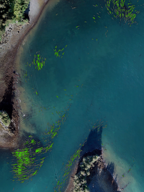
 Alaska’s Kachemak Bay and Cook Inlet seagrass meadows stabilize loose sediment, sequester carbon dioxide from the atmosphere, and are nurseries for crustaceans and fish, providing shelter for many species during vulnerable life stages. A new project is underway to map these and other inter- and subtidal habitats to help inform management decisions.
Mapping Intertidal and Subtidal Habitats of Kachemak Bay and Lower Cook Inlet, Alaska