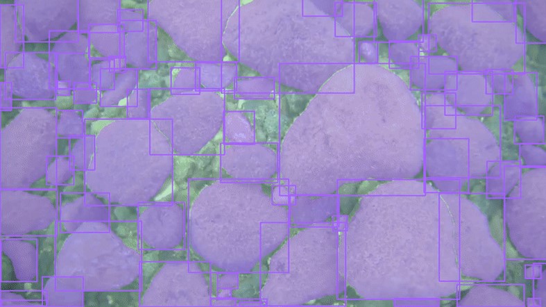
 NCCOS is supporting a collaborative mapping project in Lake Superior. AUVs and drop cameras are used to record video of benthic habitats to help ground-truth our mapping efforts. Knowing the composition of the lakebed (mud, sand, pebbles, cobbles, stones, boulders, etc.,) helps in developing maps and larger predictive models, which in turn is useful for managing the lake’s natural resources. Rather than solely relying on visual estimations, our scientists are applying AI to these ground-truthing videos to perform automated object detection, size calculation, and classification. https://coastalscience.noaa.gov/project/collaborative-lakebed-mapping-off-apostle-islands-to-support-great-lakes-restoration/
Collaborative mapping of Lake Superior lake floor using AUVs and cameras
- Published on:
- Science Area(s): Social Media