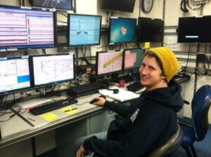
A new data visualization of deep sea life and topography has been created by NCCOS’ GIS Analyst, graduate student, and musical composer, Will Sautter.
Will Sautter’s “Exploring the Deep Sea Using Free and Open Source Data” won the Grand Prize for the American Geophysical Union’s Michael H. Frelich Student Visualization Competition. Will created the video for his final project from the Open Source ‘GIScience’ for Environmental Research class at Johns Hopkins University using only free and open source software (Google Earth, Seatube, and QGIS); he narrated and even produced his own music for the soundtrack.
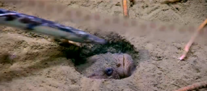
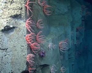
The seven minute, 36 second video highlights a NOAA Ship Okeanos Explorer research cruise on the Blake Escarpment 230 miles off the coast of South Carolina, and features dive footage of amazing deep sea coral communities. Sautter used multibeam bathymetry, remotely operated vehicle (ROV) dive tracks, and observations from NOAA’s Office of Ocean Exploration and Research and the College of Charleston to create a map that traced where the footage was being filmed. This spatial context to the ROV video footage allows the viewer to understand “the bigger picture” of the deep sea ecosystem.
The Grand Prize includes travel and research grants, membership to the American Geophysical Union and admission to the 2020 AGU Fall Meeting, and the opportunity to virtually meet NASA officials.