Home > Explore News > NOAA CoastWatch (East Coast Region) Offering Second Annual Ocean Satellite Data Training Course

NOAA CoastWatch (East Coast Region) Offering Second Annual Ocean Satellite Data Training Course

Published on: 03/11/2019

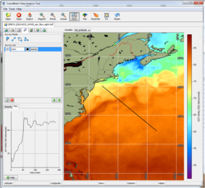
CoastWatch Data Analysis Tool: Sea Surface Temperature. Credit NOAA CoastWatch

Are you interested in using oceanographic satellite data in your work, but don't know where to start?

The NOAA CoastWatch East Coast Node will offer a free, three-day course where participants learn about environmental satellite data and how to easily obtain and use it. Participants gain hands-on experience working with the data of interest to them.

University of Maryland Earth System Science Interdisciplinary Center in College Park. Credit NOAA CoastWatch

The course will be held on May 20–22, 2019 at the University of Maryland’s Earth System Science Interdisciplinary Center in College Park, Maryland.

For more information about the course, and to register for the course, visit visit here.

For more information, contact Michelle.Tomlinson@noaa.gov or Ronald.Vogel@noaa.gov.

CoastWatch East Coast Node logo. Credit CoastWatch

Explore Similar News

About NCCOS

NCCOS delivers ecosystem science solutions for stewardship of the nation’s ocean and coastal resources to sustain thriving coastal communities and economies.

Stay Connected

Sign up for our quarterly newsletter or view our archives.

NCCOS Multimedia

Visit our new NCCOS Multimedia Gallery. 

Follow us on Social

Listen to our Podcast

Check out our new podcast "Coastal Conversations"