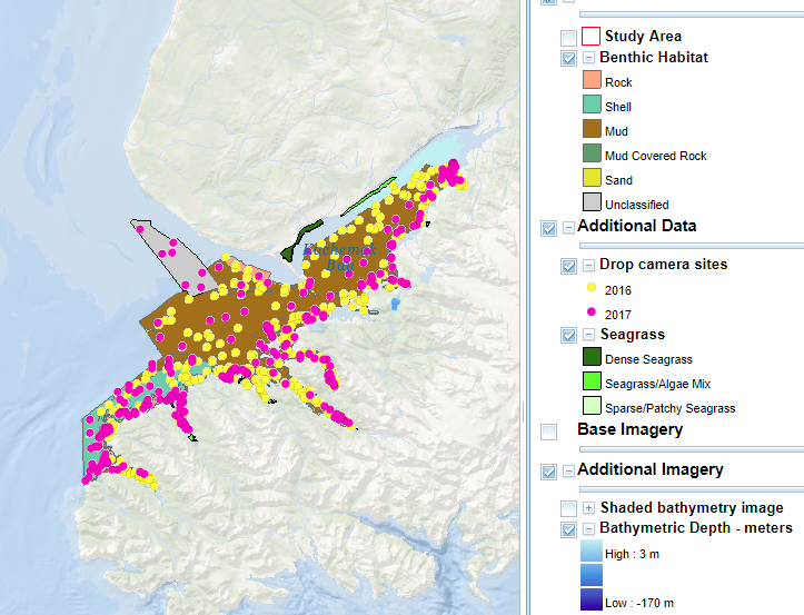
The Kachemak Bay BIOMapper, launched this year, provides detailed geospatial information on marine benthic habitats in Alaska’s Kachemak Bay.
The online portal contains a large collection of data, including aerial imagery, acoustic imagery, benthic habitat shapefiles (for use with Geographic Information Systems), ground validation sites, and underwater video.
Kachemak Bay supports fisheries, ecotourism, marine commerce, and threatened and endangered species. The bay is a NOAA Habitat Focus Area, a State of Alaska Critical Habitat Area, and the largest reserve in the National Estuarine Research Reserve system. A 28-foot tidal range creates a wide band of intertidal habitats in the bay. The bay’s abundant marine life draws waterfowl, shorebirds, moose, and bears. Marine mammals, including otters, seals, porpoise, and a variety of whales, live in the bay year round.
The Kachemak Bay BIOMapper will provide coastal managers, scientists, and the general public with data that can advance society’s understanding and technical capacity for ocean exploration and stewardship.