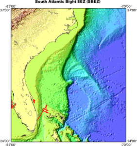
Increased use of our coastal ocean for energy, commerce, and recreation is calling for improved data to support ocean planning and ecosystem management. The baseline condition and characterization of seafloor habitats is an important base layer needed for minimizing impacts to natural resources. During the March 15-16 workshop hosted by NCCOS, Southeast and Caribbean Regional Coordination Team (SECART), and Office for Coastal Management, scientists worked together toimprove coordination and prioritization of seafloor habitat mapping activities in the SE Atlantic.

The workshop provided a forum to facilitate coordination and communication across federal and state government research and management agencies, as well asacademic and non-governmental organizations thatconduct seafloor mapping activities and/or utilize seafloor habitat data for regulatory and resource management decisions. Priority coastal management and habitat issues in the Southeast were identified as: offshore energy development, increased commerce navigation and port expansions, sand resources and beach nourishment, and living marine resource management. Twenty-six participants discussed existing data sets and shared agency priorities for future work.
The workshop was funded by SECART, NMFS Southeast Region Habitat Conservation Division, and Southeast Coastal Ocean Observing Regional Association (SECOORA).
For more information, contact Chris Taylor.
