NOAA’s new StoryMap, “Growing the Future: Siting Alaska’s Aquaculture Opportunity Areas (AOAs),” documents the process of using mapping and modeling to boost Alaska’s working waterfronts and cultivate a thriving domestic seaweed and shellfish aquaculture industry. The new offering complements a recently released WebMapper for the project that features data layers created during the mapping and modeling.
The data and maps will help inform participation in the current public comment period to gather feedback on draft AOA options prior to completion of the NCCOS-led spatial analysis, selection of final AOA options, and publication of a peer-reviewed aquaculture atlas for the Gulf of Alaska.
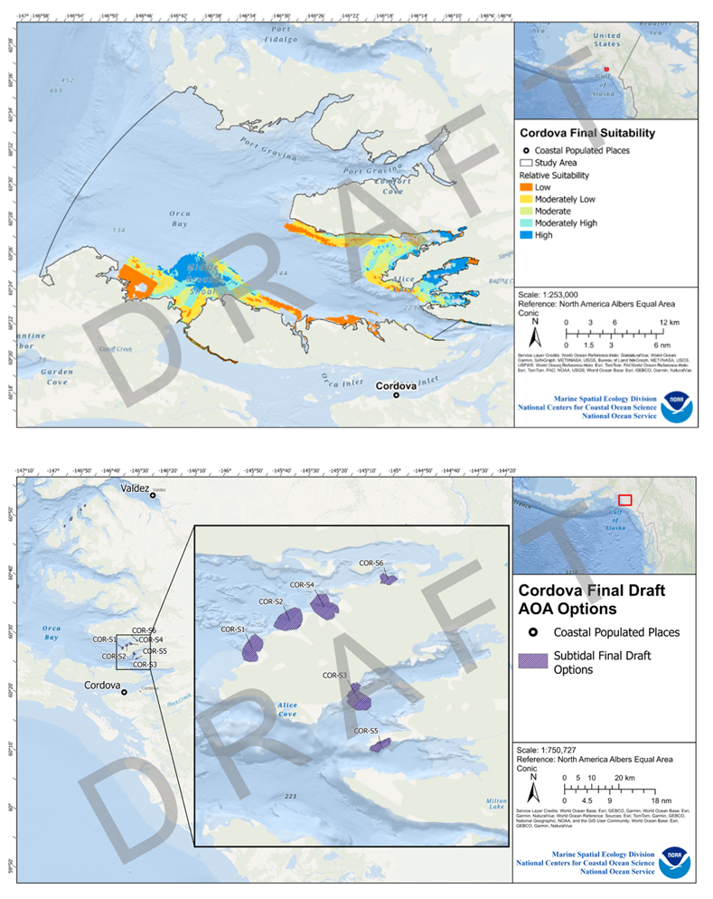
Coastal and marine planning plays an important role in sustainable coastal and ocean development. Early and comprehensive mapping and modeling helps avoid potential “ocean use” conflicts and minimize environmental impacts. NCCOS works closely with partners to develop suitability models that examine multiple, ocean use layers to identify geographic areas most likely to create a thriving aquaculture environment, all while acting sustainably, with the blue economy and a profitable future in mind.
NCCOS uses both StoryMaps and web mapping applications to showcase the modeling process, tailored to the user’s engagement preferences. The new StoryMap provides a guided narrative that illuminates the significance of this process and serves as an example of NCCOS’ spatial analysis capabilities, encompassing context, methodology, and key findings. Once acquainted with this background, users can delve into the accompanying WebMapper to interactively explore the data, apply filters, and visualize specific areas of interest.
These resources were developed by NOAA’s National Centers for Coastal Ocean Science to support NOAA’s National Marine Fisheries Service’s efforts to identify AOA options in Alaska. NOAA has directives to preserve ocean sustainability and facilitate domestic aquaculture in the U.S. through the National Aquaculture Act of 1980, the NOAA Marine Aquaculture Policy, and Executive Order 13921, “Promoting American Seafood Competitiveness and Economic Growth” (May 7, 2020).