Home > Explore News > Drone Mapping Team Receives Inaugural NCCOS Innovation Incentive Award

Drone Mapping Team Receives Inaugural NCCOS Innovation Incentive Award

Published on: 02/12/2019
Primary Contact(s): tim.battista@noaa.gov

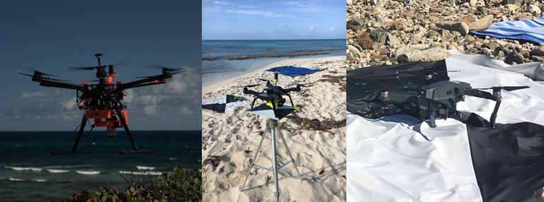
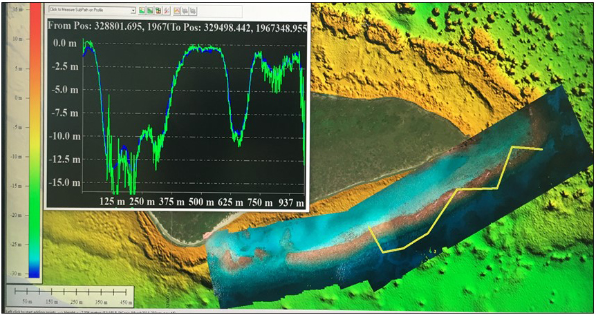
Tim Battista and Bryan Costa received the first NCCOS Innovation Incentive Award for their work using airborne drones to map shallow-water habitats.

Mapping shallow, near-shore areas for NCCOS's resource management partners is costly, frequently inefficient, and potentially dangerous using traditional methods. Tim and Bryan paired imagery from relatively inexpensive drones with Structure from Motion software to convert two-dimensional images into three-dimensional habitat maps. This innovation holds great promise for mapping many near-shore areas that are difficult to access, providing the photographs, elevation, and depth data needed to inform coastal management decisions. Tim and Bryan, with their supervisor's concurrence, will determine the best use of the $50,000 innovation prize.

Runner-up congratulations go to Dave Whitall and Andrew Mason for their use of the artificial sweetener sucralose as an indicator to discriminate nutrient pollution originating from humans from that of animals; and James Morris, Ken Riley, and Lisa Wickliffe for their development of the Gulf AquaMapper, the first spatial planning tool designed specifically for aquaculture in federal waters of the United States.

image of three drones tested in St Croix

Last year, in St. Croix, USVI, the team evaluated the quality of land elevation and water depth data acquired by three different airborne drones under a variety of conditions: DJI S900 (left), 3DR Solo (middle), and DJI Mavic (right). Credit: NOAA.


map and chart comparing drone photogrammetry with LIDAR data for reef off of Buck Island, USVI

Map showing 2018 drone photo mosaic overlaid on LiDAR depths collected in 2014 for a reef off Buck Island, USVI. The yellow transect corresponds to the depth profile (top left), showing depths derived from the drone software (green line) compared with depths measured using LiDAR (blue line). Initial results are promising, showing a tight correlation between the two down to a depth of 41 feet. Credit: NOAA


Explore Similar News

About NCCOS

NCCOS delivers ecosystem science solutions for stewardship of the nation’s ocean and coastal resources to sustain thriving coastal communities and economies.

Stay Connected

Sign up for our quarterly newsletter or view our archives.

NCCOS Multimedia

Visit our new NCCOS Multimedia Gallery. 

Follow us on Social

Listen to our Podcast

Check out our new podcast "Coastal Conversations"