NOAA scientists have recently completed surveying the status of coral reef communities on hard bottom habitats in the U.S. Virgin Islands, as part of the Coral Reef Conservation Program’s National Coral Reef Monitoring Program (NCRMP). The U.S. Caribbean islands, including three U.S. Virgin Islands and Puerto Rico, are sampled biennially via NCRMP. Researchers completed sampling around St. Croix in June, and St. Thomas and St. John in August, 2023.
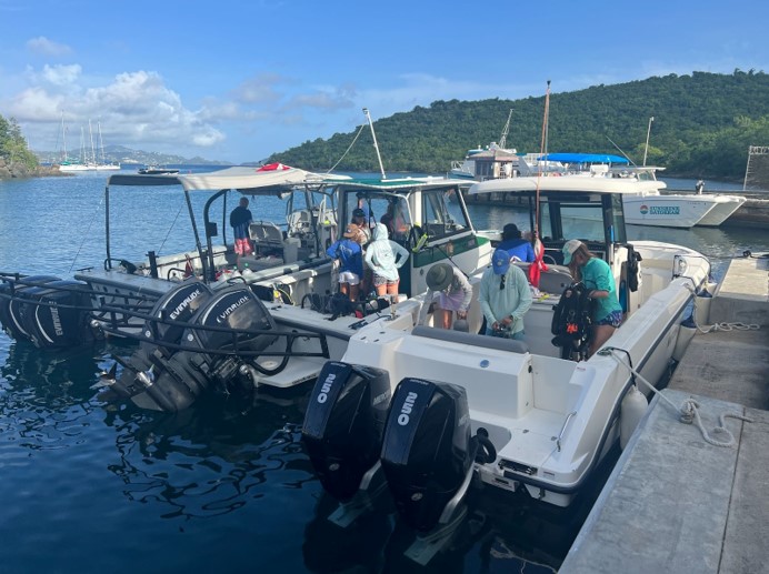
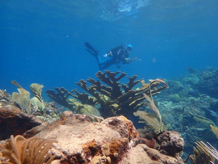
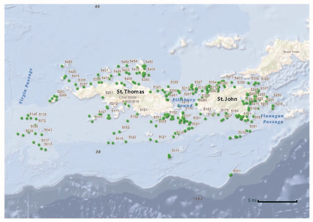
During the St. John and St. Thomas mission, nearly 40 divers from a variety of agencies worked with NOAA to monitor the coral reef communities, including scientists from the National Park Service (NPS), University of the Virgin Islands (UVI) and the Department of Natural Resources – Virgin Islands (DPNR VI). Seven boats were deployed daily to sample a minimum quota of 250 sites around the two islands. At each sample site, abundance and size information on all the fish and coral species were recorded. In addition, divers collected water samples at the sites to support the Climate Team pillar of NCRMP.
With such a massive effort underway, the team uses ArcGIS Field Maps—an online ArcGIS-supported platform developed by an NCCOS application developer—to track each boat’s status from the field and relay site details directly to the Operations Lead for the mission. This innovative technology has improved the mission efficiency in sampling, communicating to and from the field, and tracking progress.
NCRMP, part of NOAA’s Coral Reef Conservation Program, delivers high‐quality data, products, and tools to the coral reef conservation community and provides large-scale sampling to territories where resources are limited to sample at a regional scale. Data are used by local managers in the Caribbean to inform fish stock assessments, management decisions, and coral disease mitigation. Universities often use the data to support restoration and coastal protection projects as well. A program of this magnitude relies heavily on the support and participation of all our partners and the collaboration between scientists is an integral part of the program.
The team recently completed their sampling efforts in Puerto Rico. Read the most recent National Coral Reef Status Report and visit the project page to learn more about this ongoing effort.