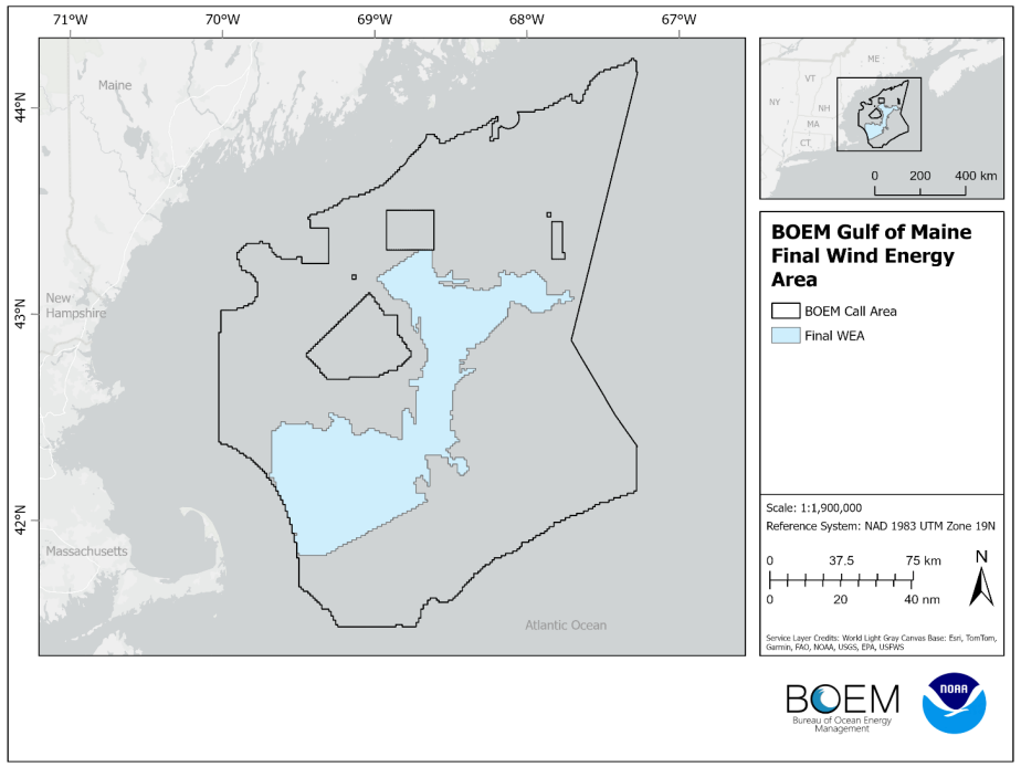
On March 15, 2024, the Bureau of Ocean Energy Management (BOEM) announced the final Wind Energy Area (WEA) in the Gulf of Maine, covering more than two million acres. This decision came after extensive collaboration with states, Tribes, local residents, ocean users, federal partners, and the public.
NCCOS played a crucial role in assisting BOEM with evaluating spatial conflicts for wind energy development in the Gulf of Maine. Using a comprehensive ocean planning spatial model, NCCOS worked with BOEM to engage with a vast number of stakeholders to consider ocean characteristics including natural resources, ocean industries, national security areas, and the wind energy requirements. The goal was to identify areas with high wind energy potential that have minimal conflicts with other ocean users and environmental resources.
The final WEA, located 23 to 92 miles off the coasts of Maine, Massachusetts, and New Hampshire, is significantly smaller than the initial Planning Area and Draft WEA. This reduction addresses conflicts with Tribal, commercial and recreational fishing areas, as well as critical North Atlantic Right Whale habitat. The designated area has the potential to generate 32 gigawatts of renewable energy, exceeding the current offshore wind goals for the Gulf of Maine.
