Home > Explore News > Request for Information: Identifying Aquaculture Opportunity Areas in Alaska

Request for Information: Identifying Aquaculture Opportunity Areas in Alaska

Published on: 10/19/2023
Primary Contact(s): christopher.schillaci@noaa.gov

In June 2023, NOAA and the state of Alaska announced a collaborative effort to identify Aquaculture Opportunity Areas (AOAs) in Alaska's waters, focusing on sustainable invertebrates (shellfish, sea cucumber, etc.) and seaweed aquaculture. Through advanced analysis and stakeholder input, these AOAs will foster responsible aquaculture that balances environmental, economic, and cultural considerations. 

In October 2023, NOAA announced the next phase of this process — a request for data, analysis, and information from the public to aid in the identification of AOAs in Alaska state waters as part of a 60-day comment period. 

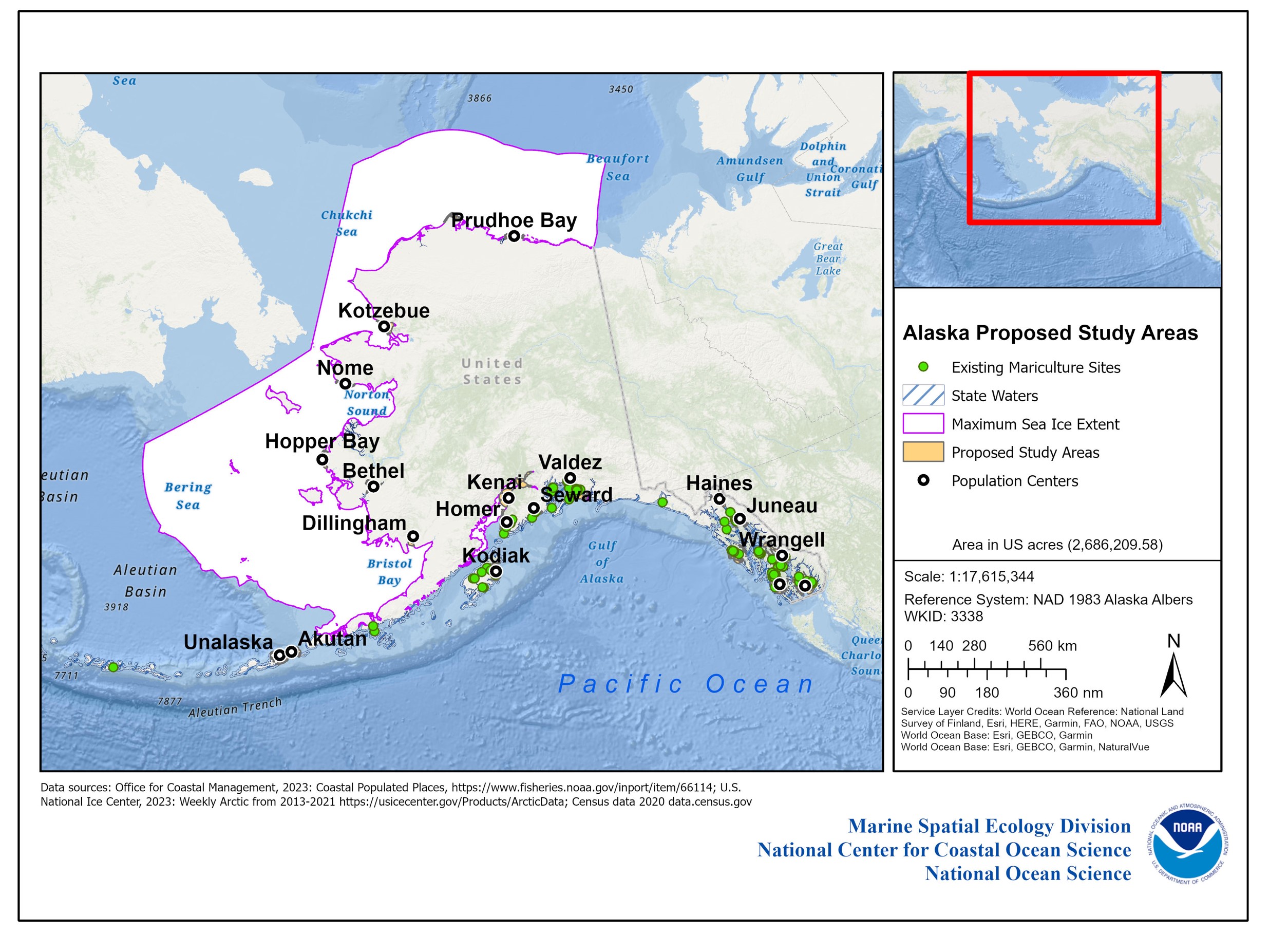
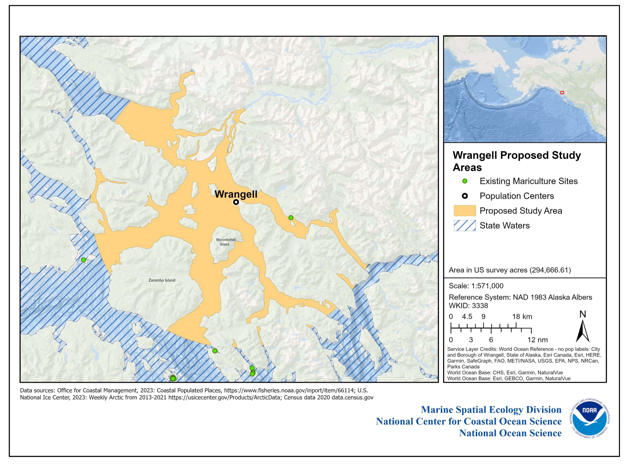
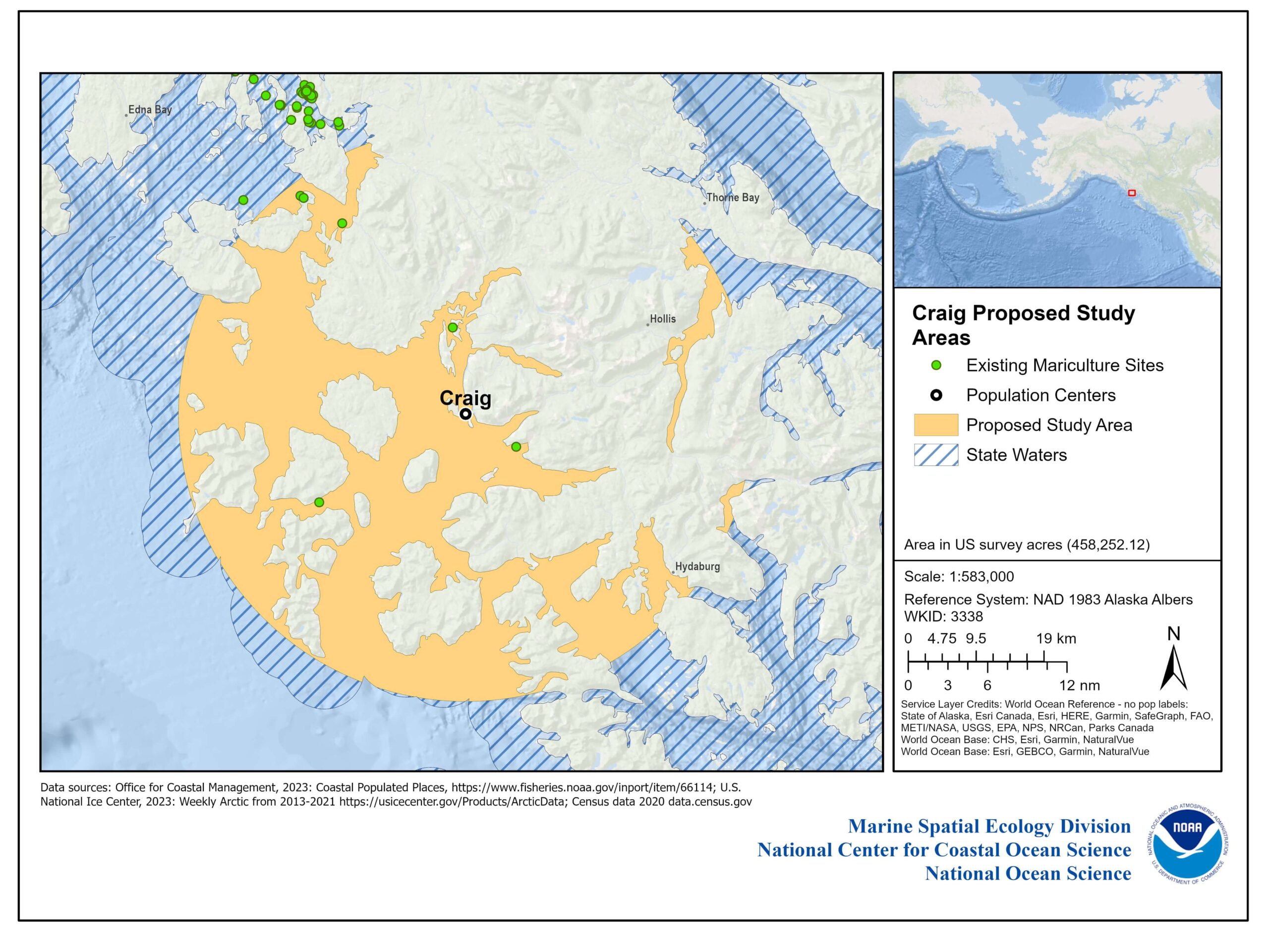
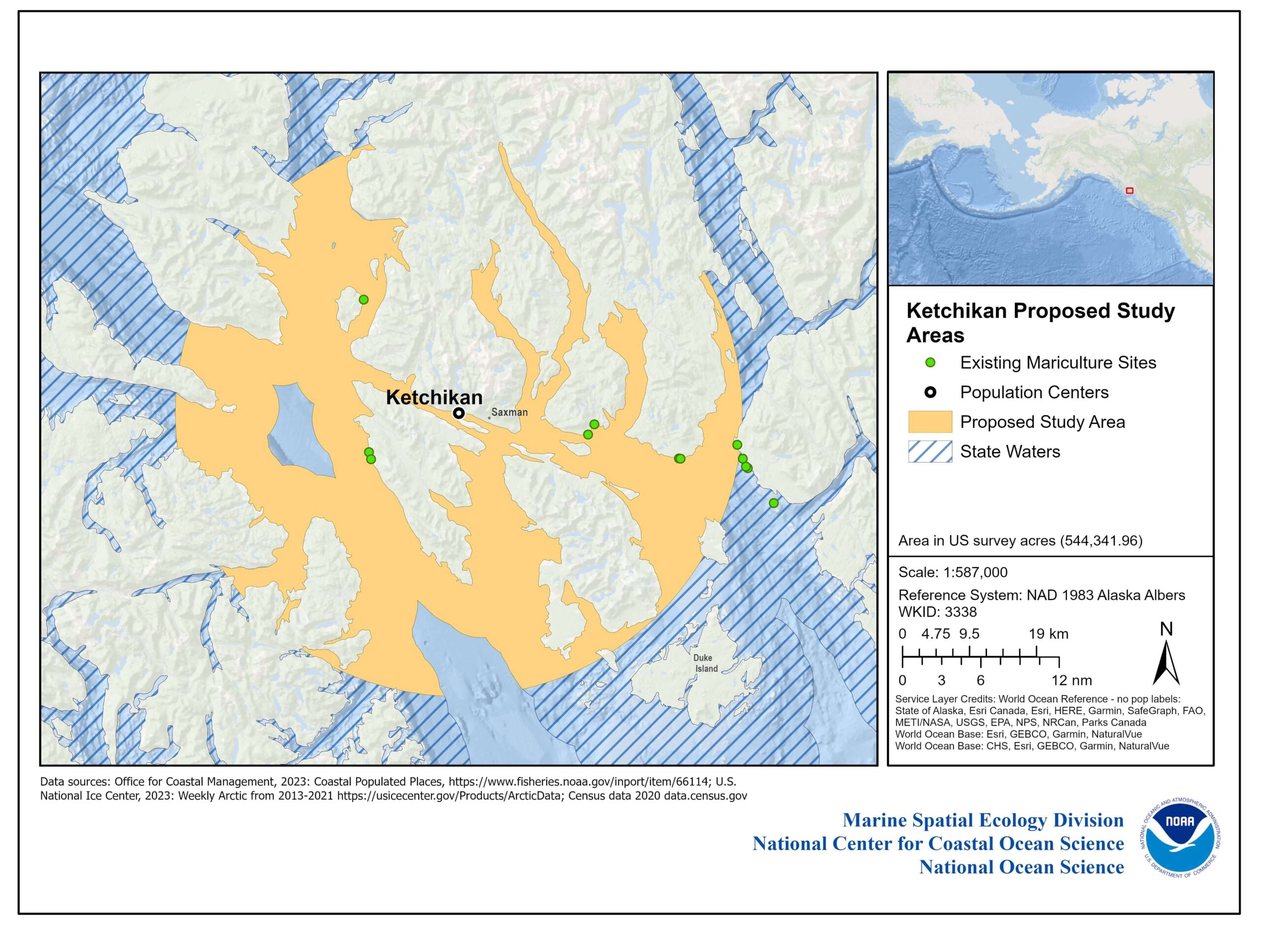
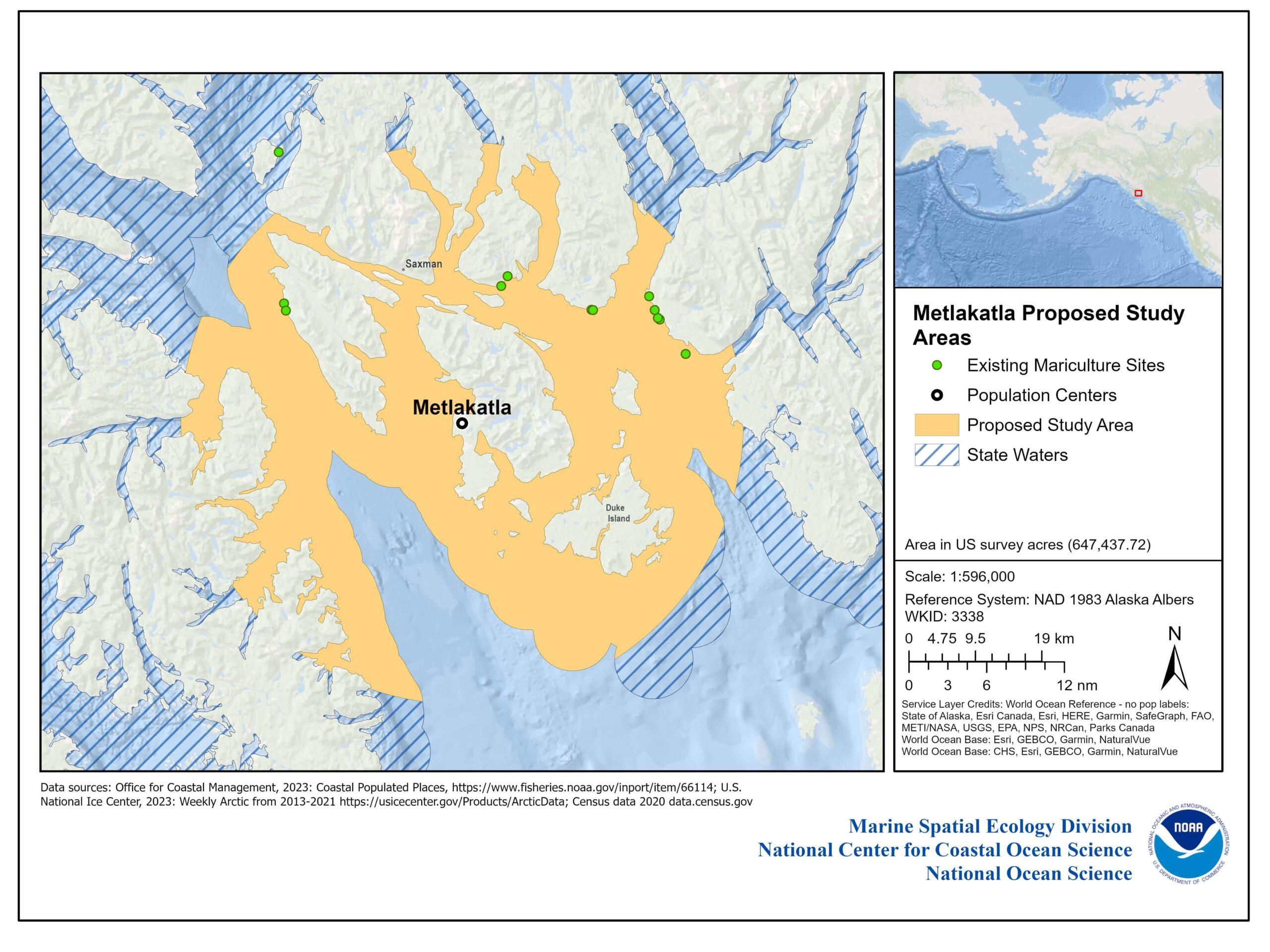
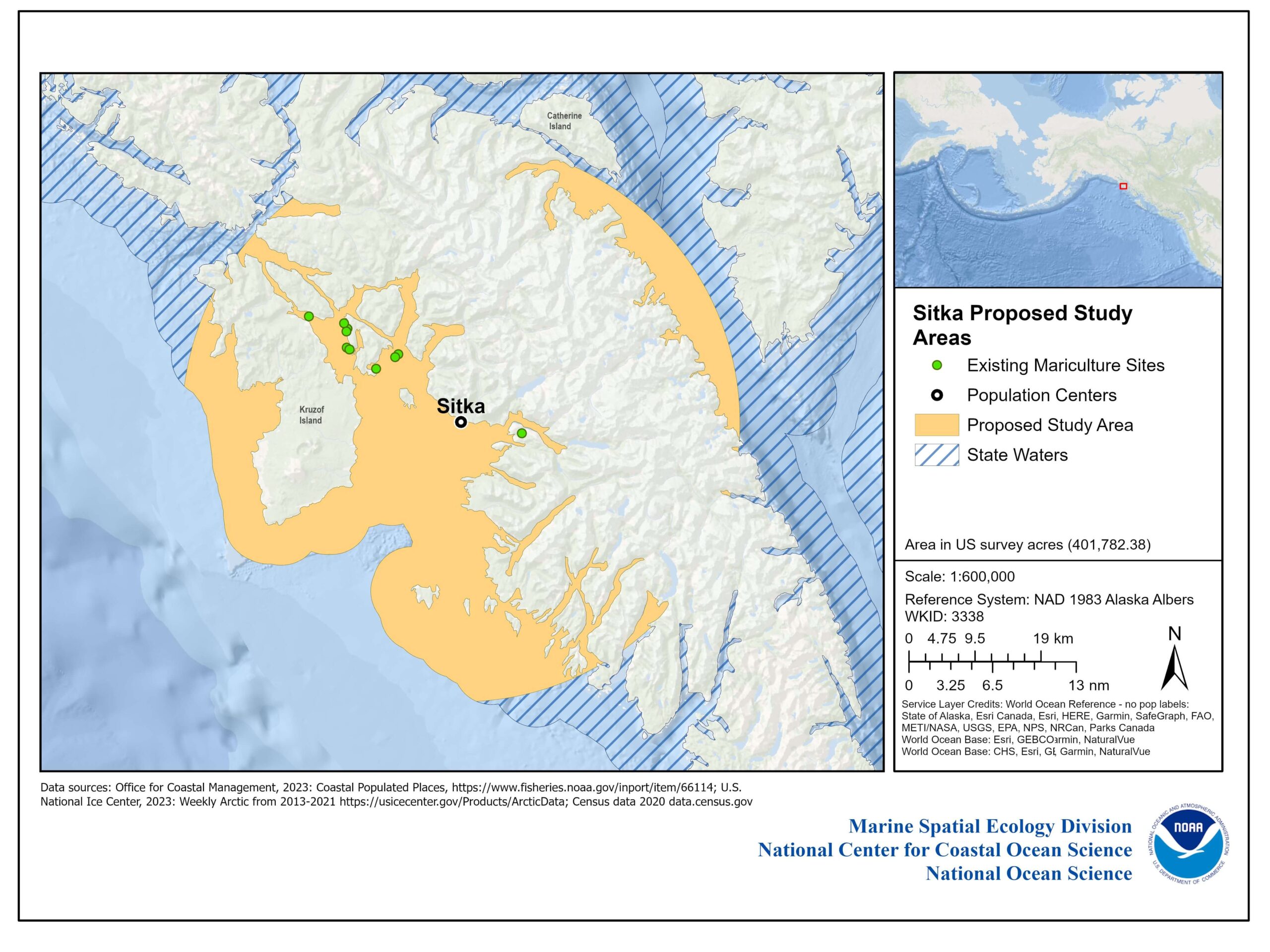
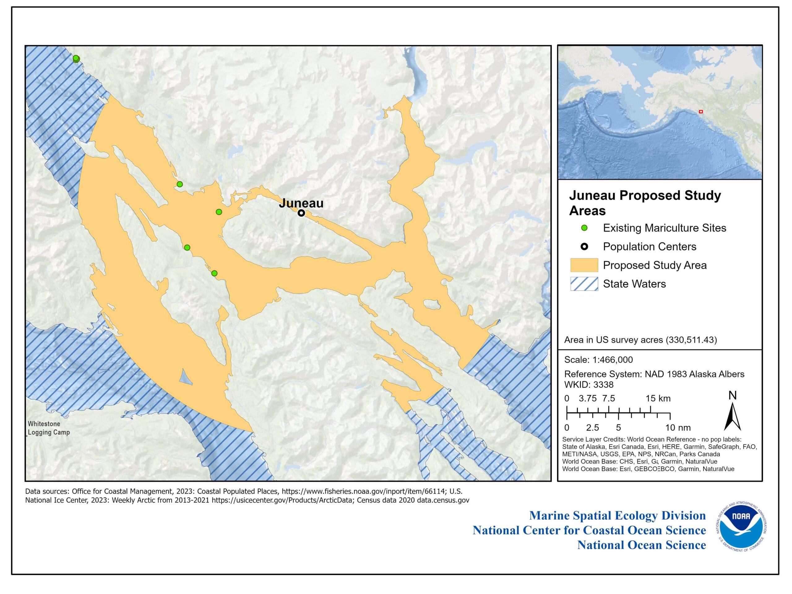
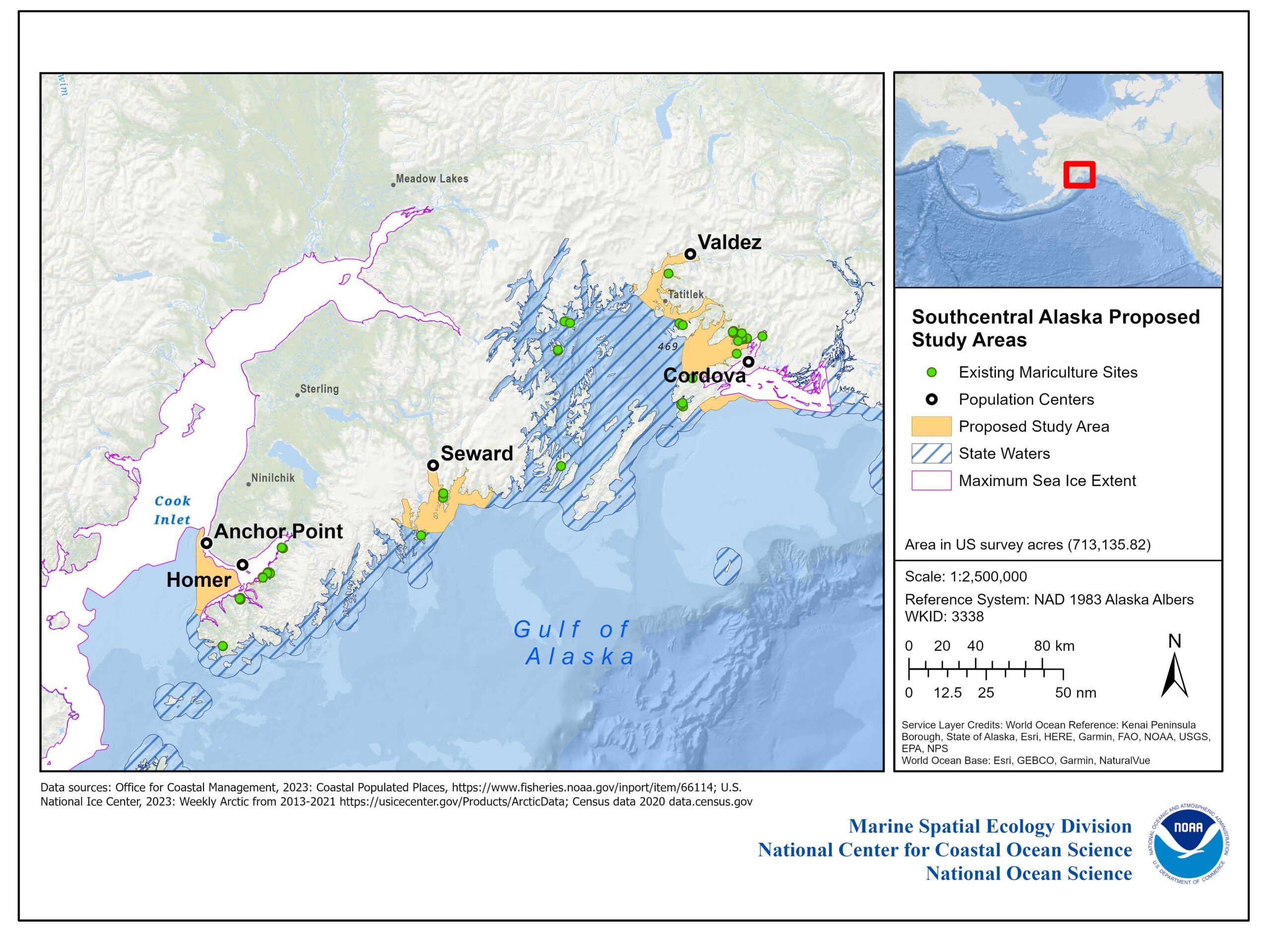
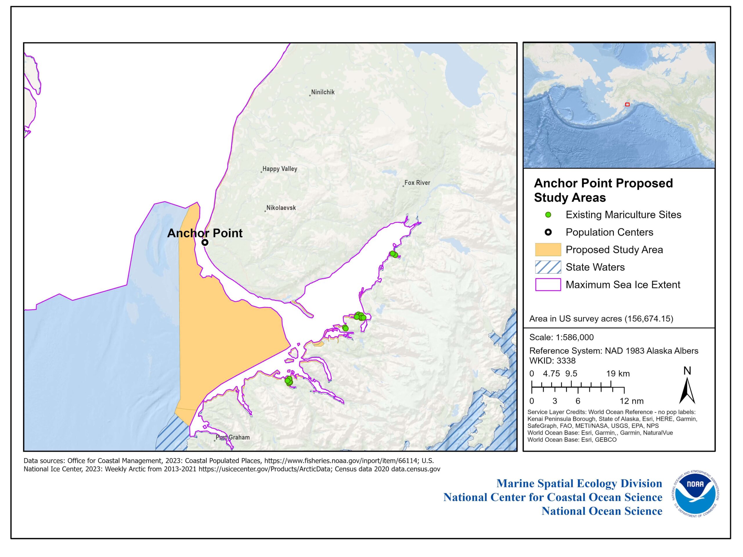
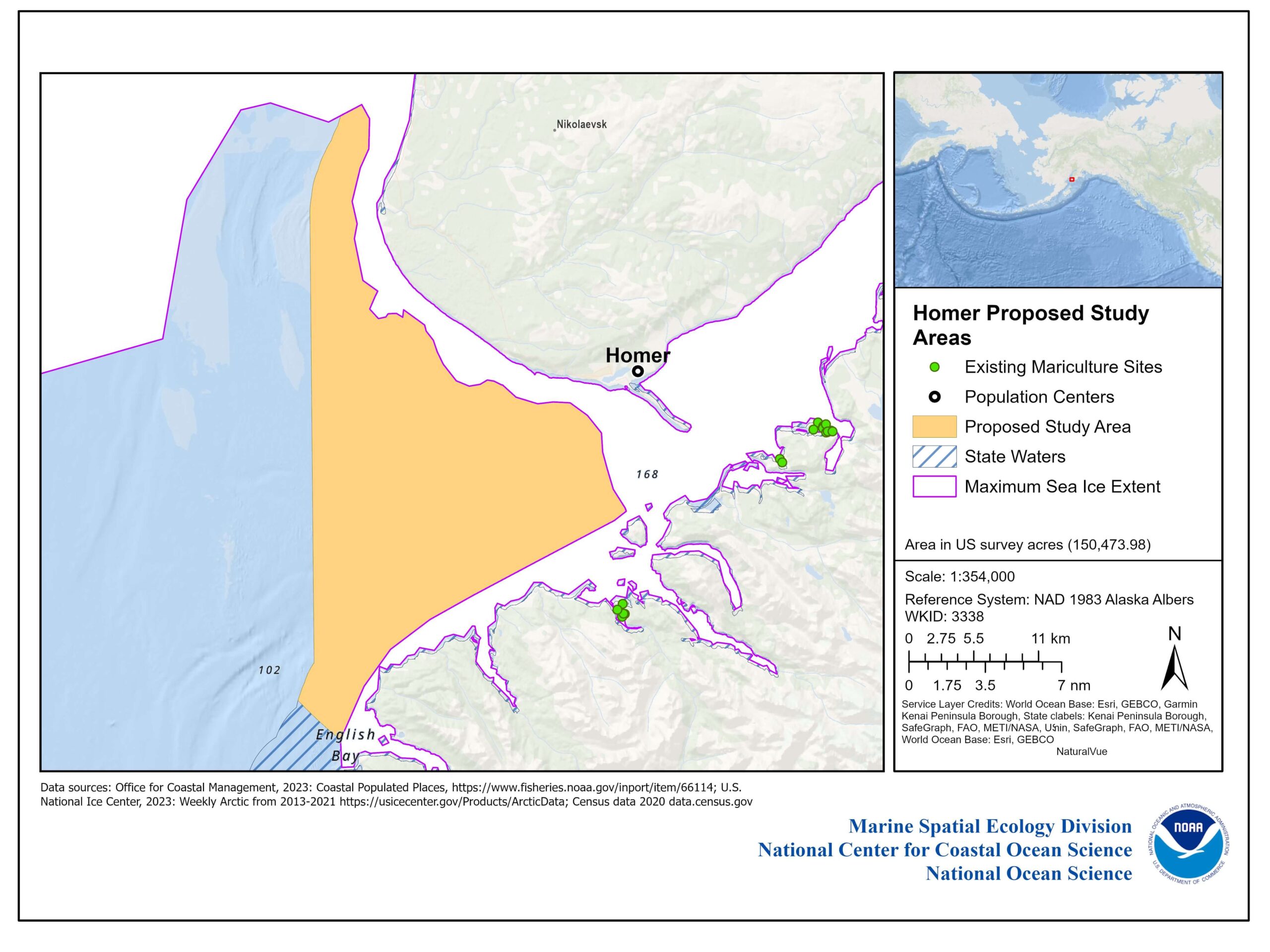
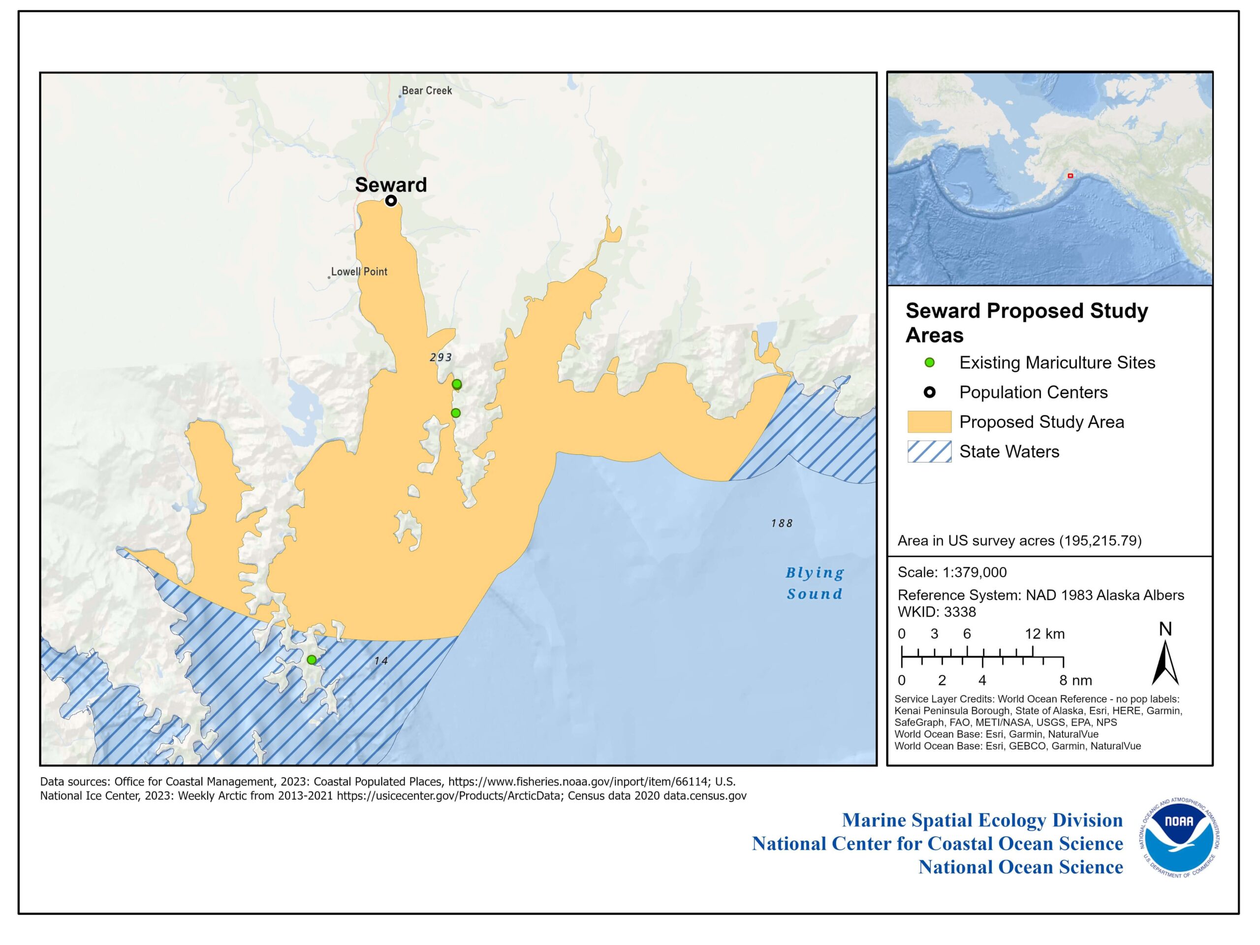
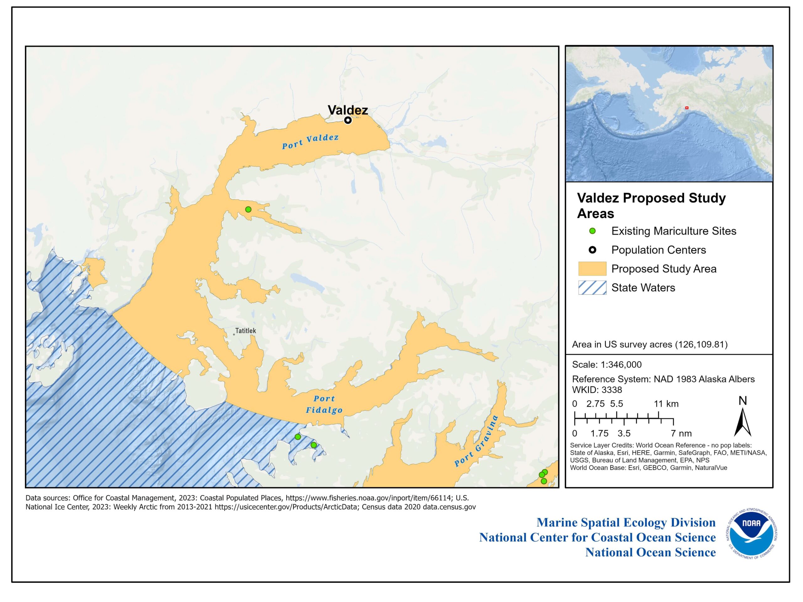
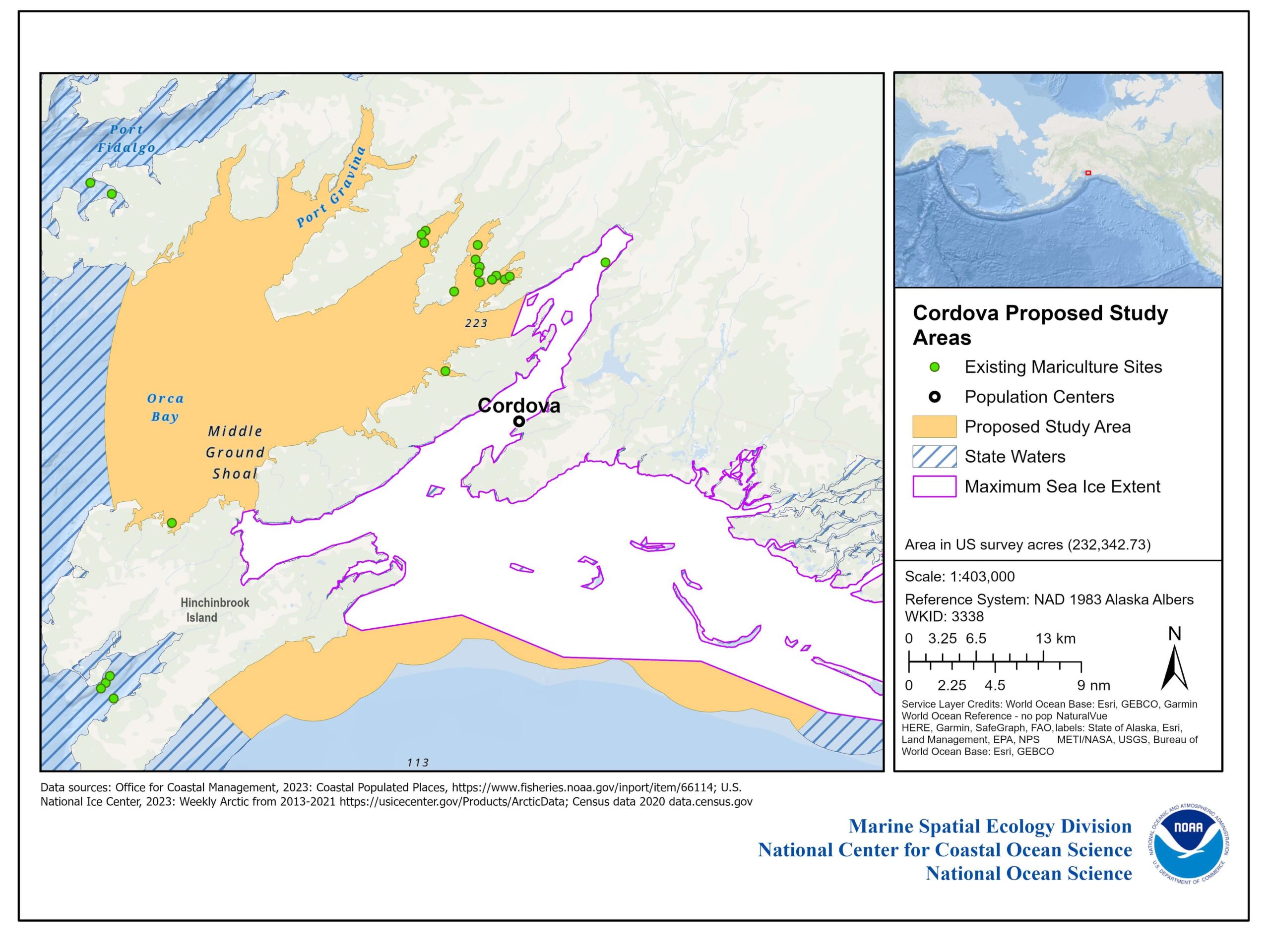
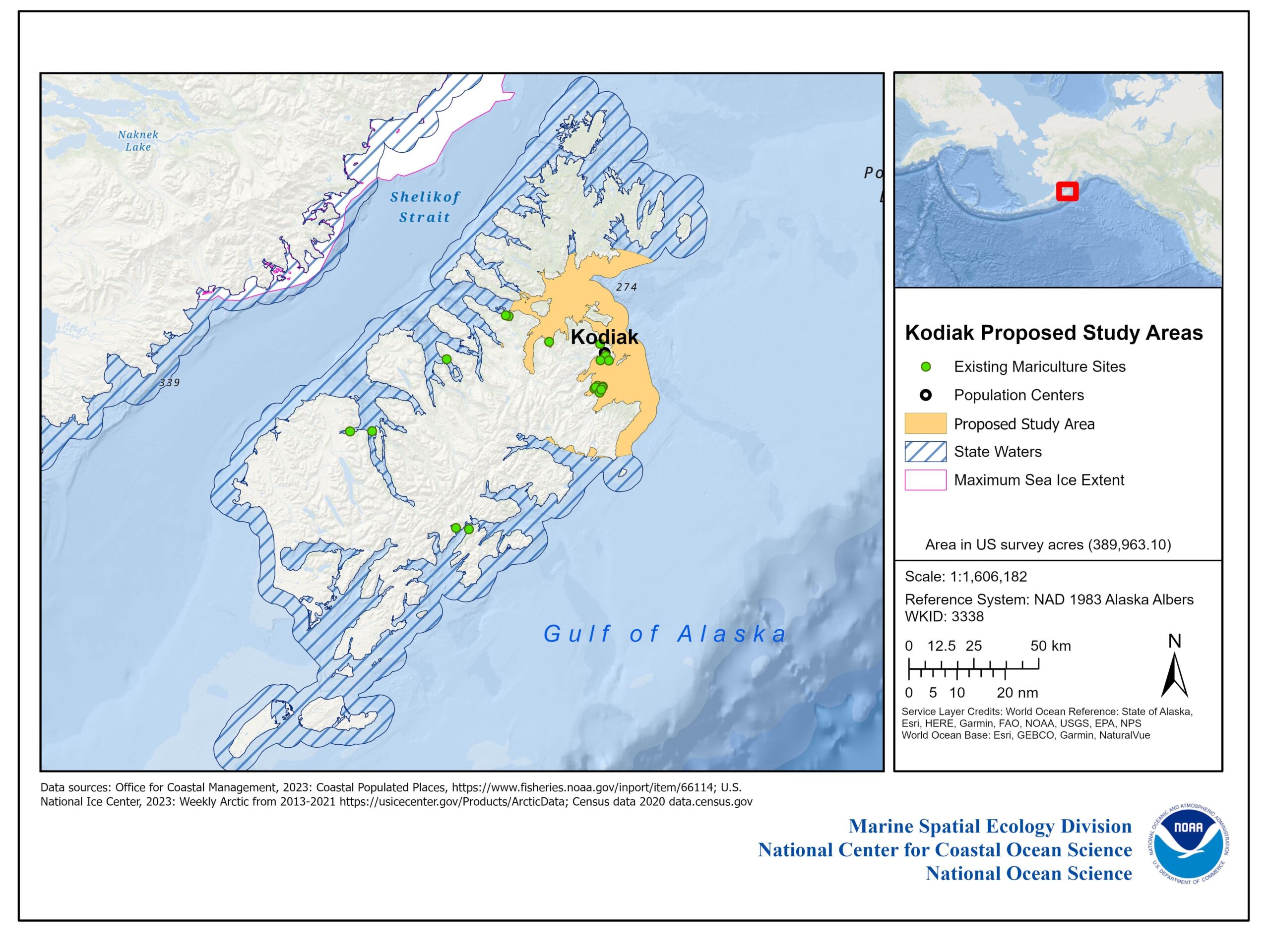
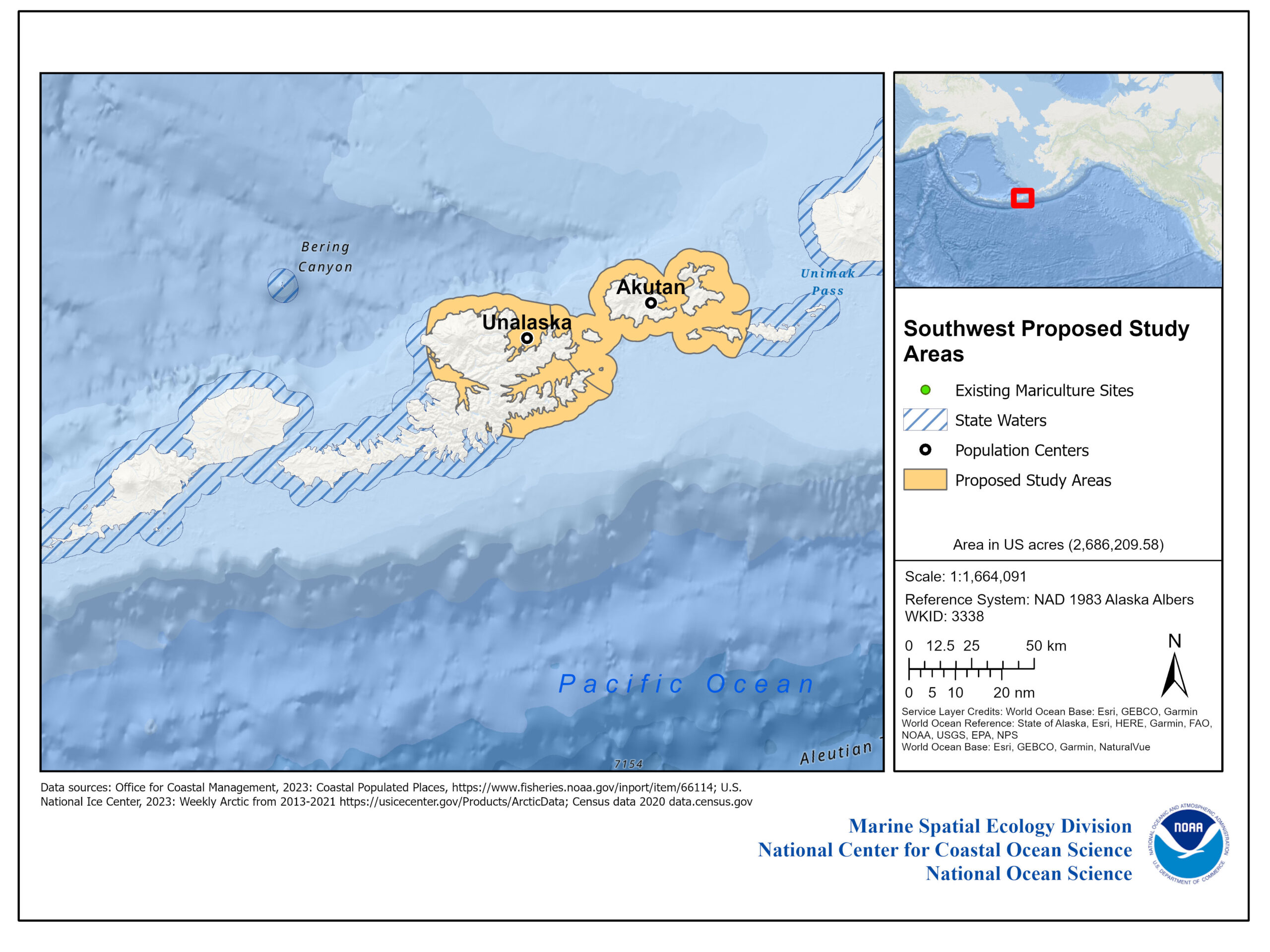
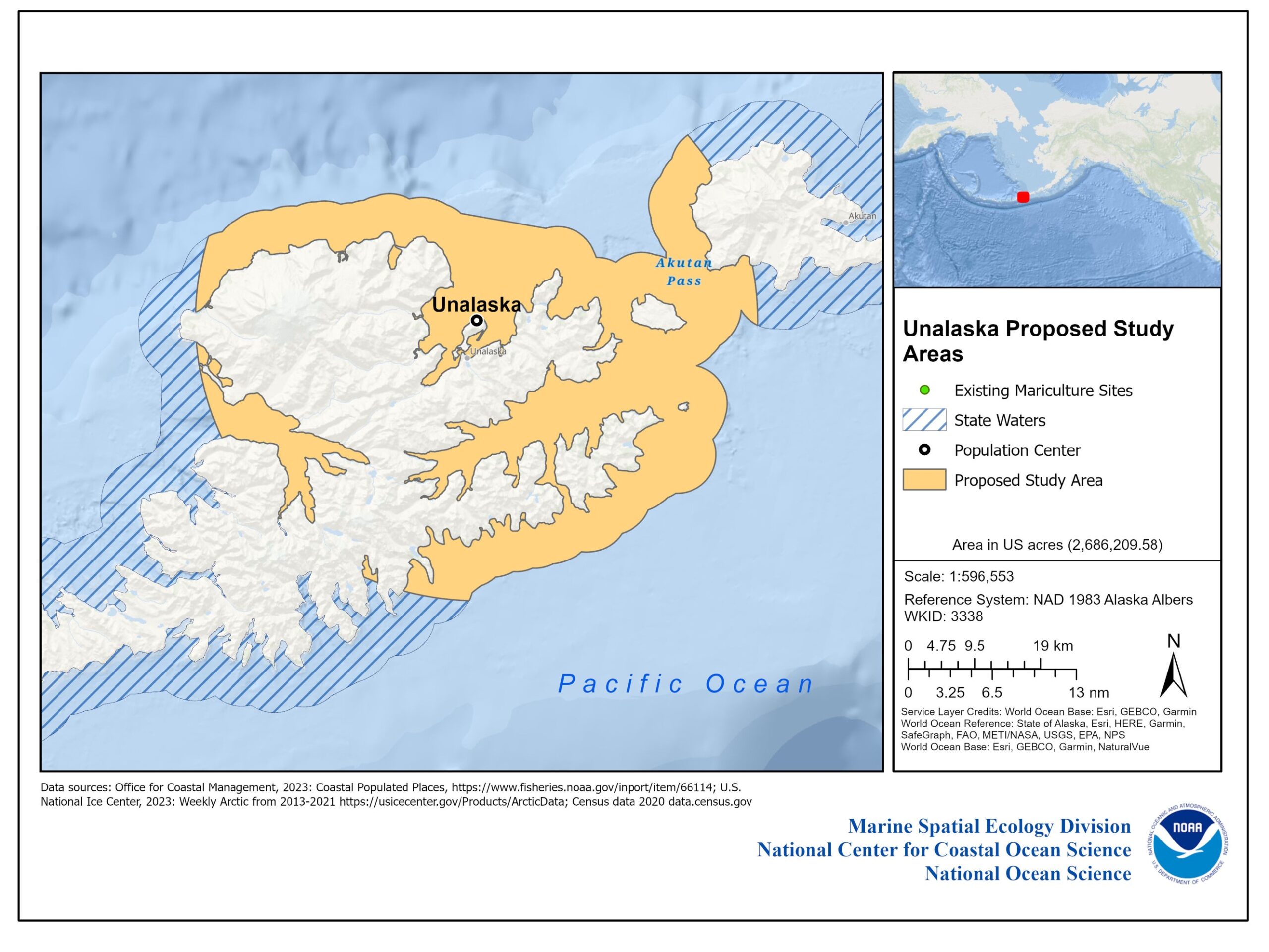
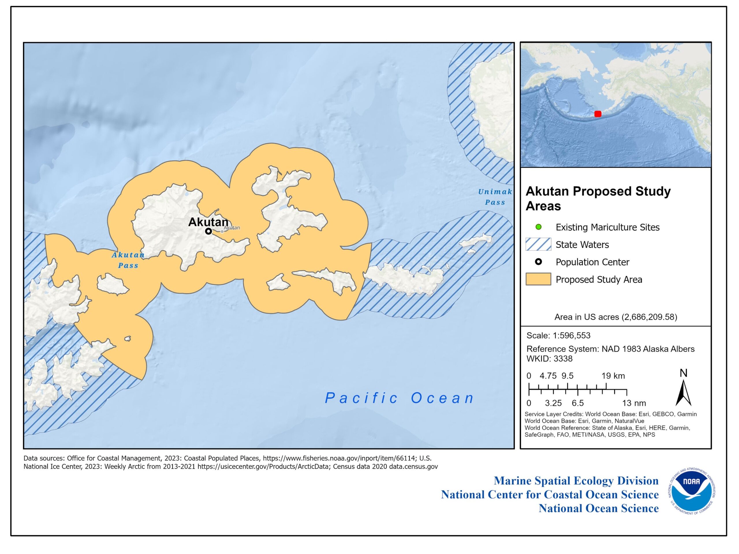
With a coastline longer than the lower 48 states combined, Alaska holds tremendous potential for aquaculture. Due to the size of this region of interest, NOAA is proposing to narrow the study areas to include only Alaska state waters within a 25-mile (40-kilometer) radius of coastal community population centers (based on 2010 census data) as a proxy for needed infrastructure to support aquaculture development in Alaska, and Alaska state waters that do not experience sea ice cover (based on a 10-year aggregate maximum sea ice cover reported by the U.S. National Ice Center). 

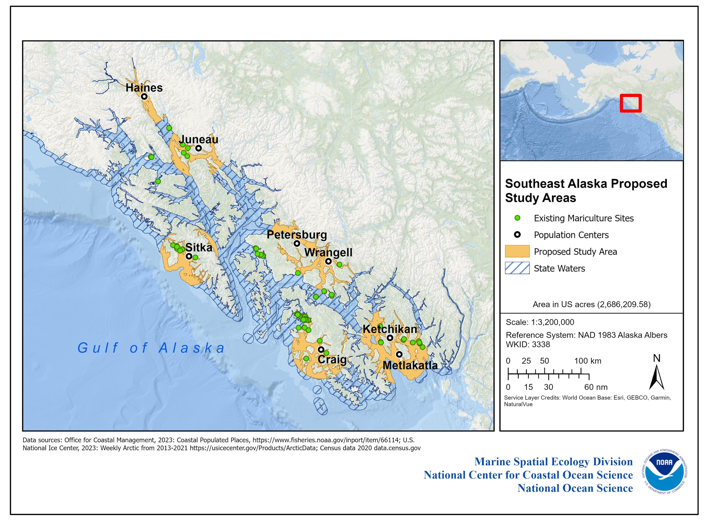
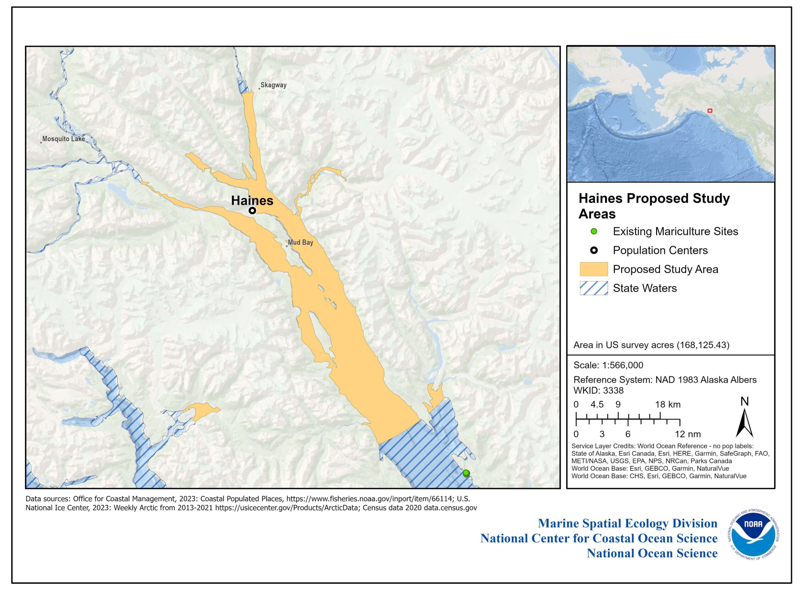
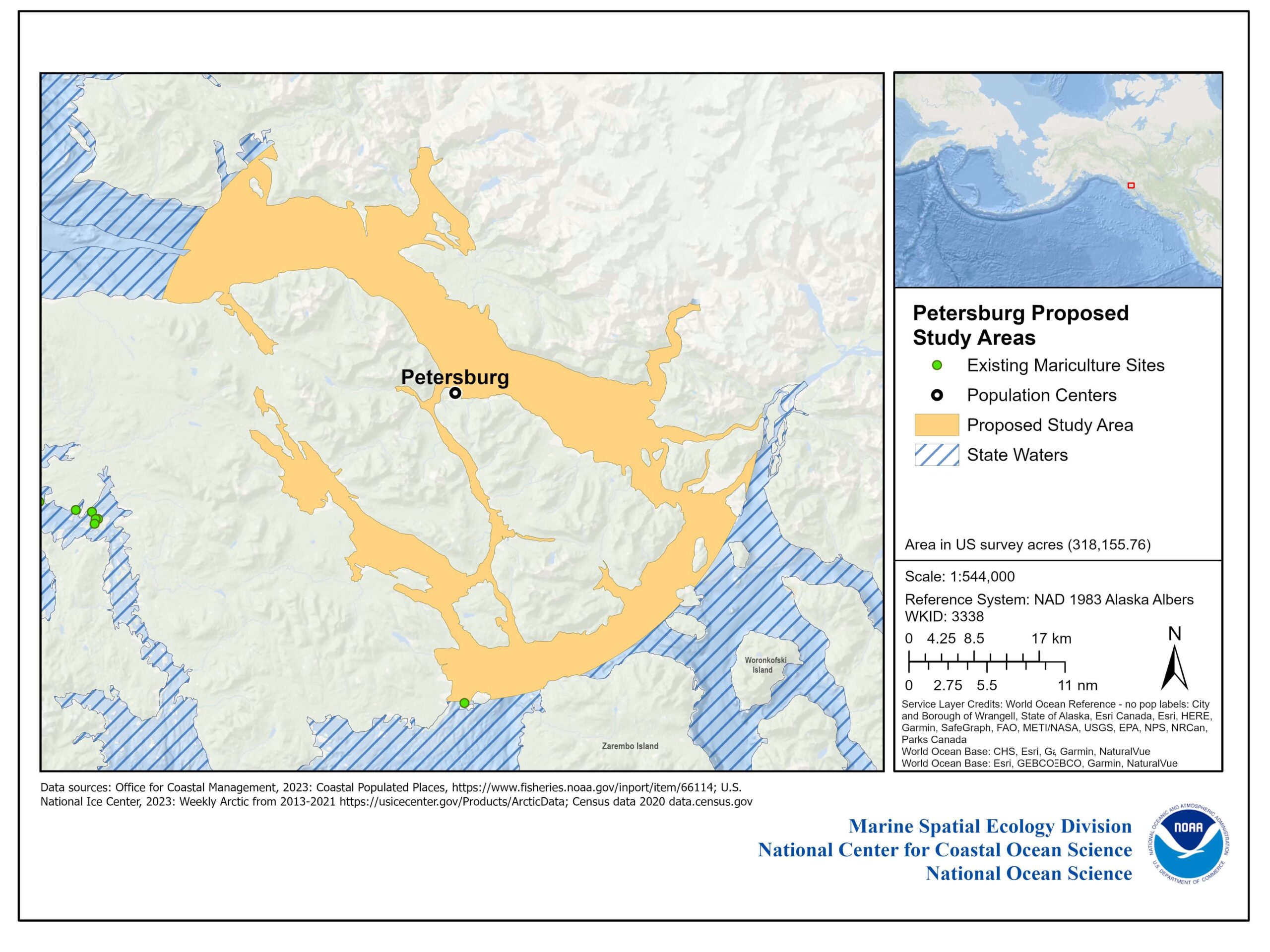
Using these parameters, NOAA’s National Centers for Coastal Ocean Science (NCCOS) has identified preliminary study areas located off the southeast, southcentral, and southwest coasts of Alaska (see maps below). Please note: due to complete ice coverage for the Kenai and Anchorage population centers, maps for these areas are excluded.

Overview

Map of Alaska showing proposed study areas.

Figure 1. Distribution of Proposed Study Area options in state waters of Alaska. Orange areas represent proposed study areas, green dots represent existing mariculture sites, and white areas with purple outlines represent the aggregate maximum sea ice cover over the previous 10 years.

Southeast

Figure 2. Distribution of Proposed Study Area options in state waters off Southeast Alaska. Orange areas represent proposed study areas, and green dots represent existing mariculture sites.

Figure 3. Proposed Study Area off Haines, Alaska (orange). Green dots represent existing mariculture sites.

Figure 4. Proposed Study Area off Petersburg, Alaska (orange). Green dots represent existing mariculture sites.

Figure 5. Proposed Study Area off Wrangell, Alaska (orange). Green dots represent existing mariculture sites.

Figure 6. Proposed Study Area off Craig, Alaska (orange). Green dots represent existing mariculture sites.

Figure 7. Proposed Study Area off Ketchikan, Alaska (orange). Green dots represent existing mariculture sites.

Figure 8. Proposed Study Area off Metlakatla, Alaska (orange). Green dots represent existing mariculture sites.

Figure 9. Proposed Study Area off Sitka, Alaska (orange). Green dots represent existing mariculture sites.

Figure 10. Proposed Study Area off Juneau, Alaska (orange). Green dots represent existing mariculture sites.

Southcentral

Figure 11. Distribution of Proposed Study Area options for mariculture in state waters off Southcentral Alaska. Orange areas represent the proposed study areas, and green dots represent existing mariculture sites. White areas with purple outline represent the aggregate maximum sea ice cover over the previous 10 years. Please note, due to complete ice coverage for the Kenai and Anchorage population centers, maps for the areas are excluded.

Figure 12. Proposed Study Area off Anchor Point, Alaska (orange). Green dots represent existing mariculture sites. White areas with purple outline represent the aggregate maximum sea ice cover over the previous 10 years.

Figure 13. Proposed Study Area off Homer, Alaska (orange). Green dots represent existing mariculture sites. White areas with purple outline represent the aggregate maximum sea ice cover over the previous 10 years.

Figure 14. Proposed Study Area off Seward, Alaska (orange). Green dots represent existing mariculture sites.

Figure 15. Proposed Study Area off Valdez, Alaska (orange). Green dots represent existing mariculture sites.

Figure 16. Proposed Study Area off Cordova, Alaska (orange). Green dots represent existing mariculture sites. White areas with purple outline represent the aggregate maximum sea ice cover over the previous 10 years.

Kodiak

Figure 17. Proposed Study Area for the site off Kodiak in U.S. state waters of Alaska (orange). Green dots represent existing mariculture sites. White areas with purple outline represent the aggregate maximum sea ice cover over the previous 10 years.

Southwest

Map of Southwest Alaska

Figure 18. Distribution of Proposed Study Area options in state waters off Southwest Alaska. Orange areas represent proposed study areas, and green dots represent existing mariculture sites. White areas with purple outline represent the aggregate maximum sea ice cover over the previous 10 years.

Unalaska

Map of Unalaska, Alaska

Figure 19. Proposed Study Area for the site off Unalaska in U.S. state waters of Alaska (orange).

Akutan

Map of waters around Akutan, Alaska showing proposed study areas.

Figure 20. Proposed Study Area for the site off Akutan in U.S. state waters of Alaska (orange).

Following this public comment period to finalize the study areas, NOAA-NCCOS will use the best available data, as well as Indigenous Knowledge, to account for key environmental, economic, social, and cultural considerations to identify areas that may support sustainable aquaculture development while minimizing environmental impacts and conflicts with other ocean uses. 

Public insights are crucial in shaping this effort. Participate in the Request for Information (RFI) process to contribute to the future of Alaska's aquaculture.

Explore Similar News

About NCCOS

NCCOS delivers ecosystem science solutions for stewardship of the nation’s ocean and coastal resources to sustain thriving coastal communities and economies.

Stay Connected

Sign up for our quarterly newsletter or view our archives.

NCCOS Multimedia

Visit our new NCCOS Multimedia Gallery. 

Follow us on Social

Listen to our Podcast

Check out our new podcast "Coastal Conversations"