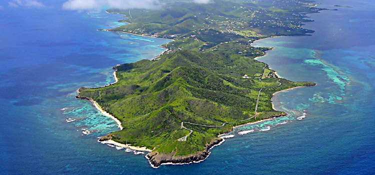
National Centers for Coastal Ocean Science (NCCOS) researchers and managers from the St. Croix East End Marine Park recently teamed to characterize and assess the status of the park’s marine environment, as well as identify areas where land-based threats -like pollution and runoff -may impact coral reef ecosystems in the park. The results are now available in a newly released document called, Land-Sea Characterization of the St. Croix East End Marine Park.
The East End Marine Park encompasses nearly 39,000 acres of underwater habitats that are home to a variety of coral reefs, fish and invertebrates. The park is also a favorite destination for residents and tourists alike. Park managers and NCCOS scientists identified a number of information gaps in existing knowledge of the living marine resources within the park. They also recognized that data the park did have were inadequate for measuring the effectiveness of future management activities.
‘The maps and graphics in the document are great. Having maps that delineate all the watersheds -especially the sensitive, more threatened ones – are great management tools,’ St. Croix East End Marine Park ranger John Farchette, said. ‘These findings also let us know how to prioritize our very limited resources. In the future, we can use the baseline data presented here to find management solutions that work.’Scientists examined the park from a holistic, ridge-to-reef standpoint, investigating factors like: land cover; the presence of dirt roads; and the distribution of marine habitats, sea floor life and reef fish assemblages. They also scoured published literature and field survey data to identify and locate specific coral species that may be more sensitive to land-based sources of pollution.
‘Our approach provides on-the-ground managers with information on the distribution, diversity and seascape condition of marine communities across the park,’ Dan Dorfman, one of the NCCOS scientists on the project, said. ‘Our findings not only indicate where important marine resources are distributed, but also ties the marine communities to the up-slope watersheds where human activities can impact the health of marine communities.’
Based on the findings from their analysis, NCCOS researchers were able to make several key recommendations to managers of the watershed, including:
- Development of a prioritization strategy based on information in the report to identify direct threats that impacted watersheds pose to vulnerable corals;
- Managing areas up-slope of the watershed impact zones that contain sensitive species to ensure conditions in these environments are sustainable; and
- Using the survey data from this study as a baseline to assess future performance of the park as part of an adaptive management strategy.
NCCOS researchers expect that the methods applied in this characterization of the St. Croix East End Marine Park will help managers and scientists better understand land-sea connections and prioritize management actions during the upcoming revision of the park’s management plan.
Simon Pittman, a NCCOS landscape ecologist and lead investigator with this project, pointed out that, ‘The approach we developed here is now contributing to a reef resilience assessment in the U.S. Virgin Islands, but also has great potential for application to other regions of the world where rapid and cost-effective assessments of threats from land to the sea are required.’
This work was conducted as part of NOAA’s Coral Reef Conservation Program (CRCP) Caribbean Coral Reef Ecosystem Monitoring project; a partnership effort between NOAA’s National Ocean Service, NCCOS, U.S. Virgin Islands Department of Planning and Natural Resources – Division of Fish and Wildlife, U.S. Geological Survey, the National Park Service (NPS), the University of the Virgin Islands and the University of Hawaii.
This project was funded by theCoral Reef Conservation Program, the National Centers for Coastal Ocean Science, and theNational Park Service.
