NCCOS is preparing toembark on its twelfth yearof an ongoing scientific research mission on board the NOAA Ship Nancy Foster, funded by NOAA’s Coral Reef Conservation Program. The missionwill combine methods of multibeam and fish sonar with video captured from an ROV(remotely operated vehicle) and environmental data collected from an autonomous glider from March 28 to April 7around the islands of St. Croix and St. Thomas in the U.S. Virgin Islands. Integrating these mapping and observation activities gives the scientists a more complete picture of these ecosystems, and they can actually visualize how fish are distributed around bottom features across the entire region within coastal waters of St. Croix and St. Thomas, USVI.
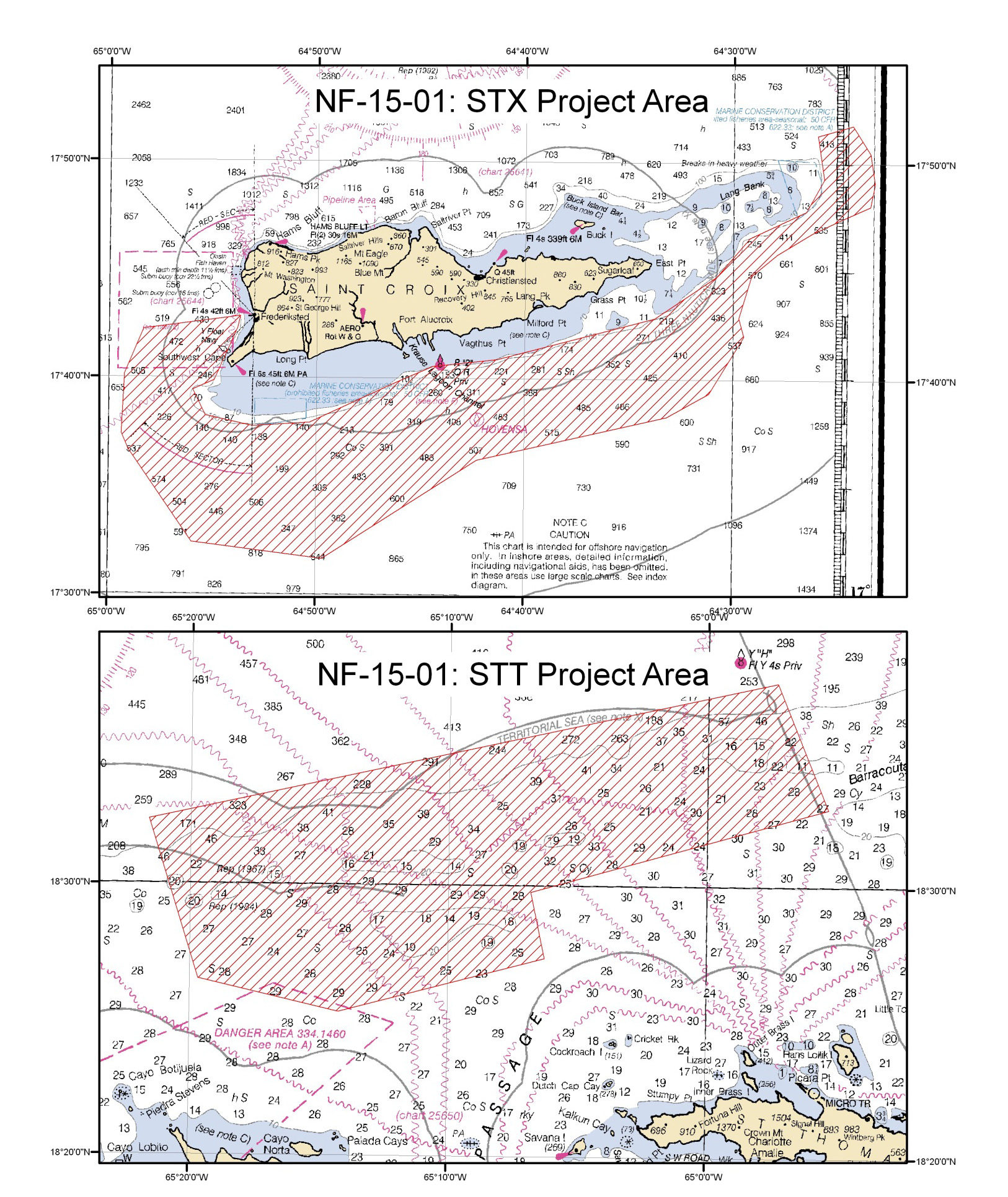
The data gathered from these annual missions are used to generate maps for use by local policy makers to determine the best approach for managing and protecting these important habitats and the marine species that live here, as well as supporting future research initiatives.
For more information check out the mission web portal here.
If you have further questions, contact Tim.Battista@noaa.gov.