Notes from the scientific expedition team aboard the NOAA ShipNancy Foster (March 15 -April 3):
How I Spent My Spring Break
By Paul Quackenbush, Guest Blogger from Middlebury College
Ayy Matey! Welcome aboard the Nancy Foster!
It’s nearing the end of our time aboard the NOAA Ship Nancy Foster, and although I have yet to learn to speak pirate, I have started to settle into the rhythm of life at sea. Contrary to my expectations, life on a ship is quite comfortable. We have an exercise room, a spacious TV room, and the food is awesome.
In addition to the excitement of being at sea, I’m thrilled to be part of the exciting research being conducted aboard the Nancy Foster. The main goal of this research trip is to map central fish habitat offshore of St. Croix in the U.S. Virgin Islands.
Here’s a map showing much of what we’ve collected so far using the ship’s multibeam sonar:
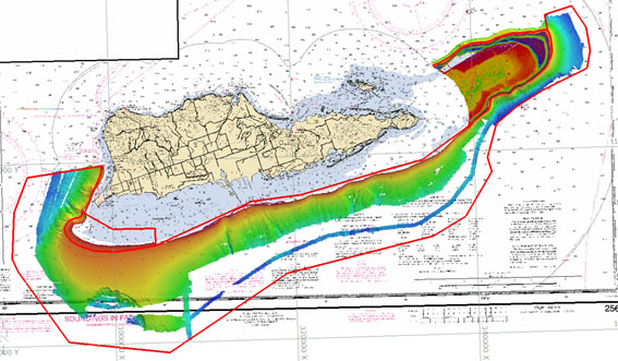
Colder colors represent deeper areas, while warmer colors represent shallower areas.
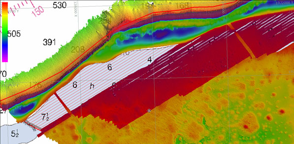
We collect this data by going back and forth in parallel lines over the ocean bottom, continuously collecting data on the size and number of fish, as well as the depth and characteristics of the ocean bottom. Occasionally, our lines are slightly too far apart, leaving holes in our data, or ‘holidays’ for short. In recent days, we’ve been attempting to fill in some of these ‘holes’ by resurveying these areas.
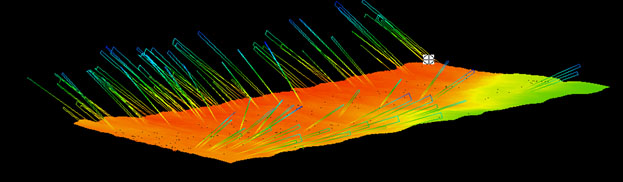
One of my primary tasks aboard the Nancy Foster is to process the data collected with the multibeam sonar, which provides a continuous picture of the ocean floor. Sometimes the data look great:
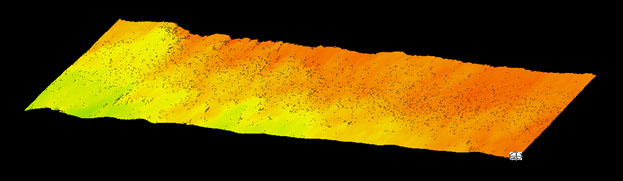
And other times the data need a haircut:
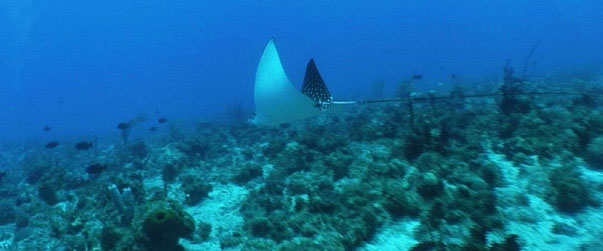
Once it is processed, we can use these data, called backscatter, to start characterizing the ocean floor and identifying areas that might contain central fish habitat. We then send a remotely operated vehicle (ROV) down to investigate these areas and see what’s down there. The video that the ROV transmits back to the ship is fascinating:
Taken together, the many sources of data we’re collecting on the Nancy Foster combine to paint a picture of the species and habitat composition and distribution in this area. These data will thus serve as a starting point for future research and will help to inform the island’s natural resource managers in protecting and conserving these invaluable marine resources.
Paul is currently a senior geography major at Middlebury College in Vermont and jumped at the opportunity to get his feet wet in oceanography as an intern with NOAA over his spring break.