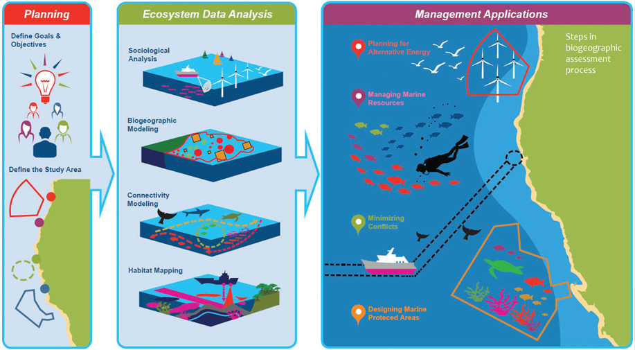
 NCCOS is conducting a study of available spatial data across four U.S. territories (Guam, the Commonwealth of the Northern Mariana Islands, Puerto Rico, and USVI) to characterize each region’s marine environment, benthic habitat, and wildlife. This biogeographic assessment will establish a baseline for BOEM to review future renewable energy plans and manage their impacts. Learn more: https://coastalscience.noaa.gov/project/marine-biogeographic-assessment-of-u-s-territories/
NCCOS is conducting a study of available spatial data across four U.S. territories
- Published on:
- Science Area(s): Social Media