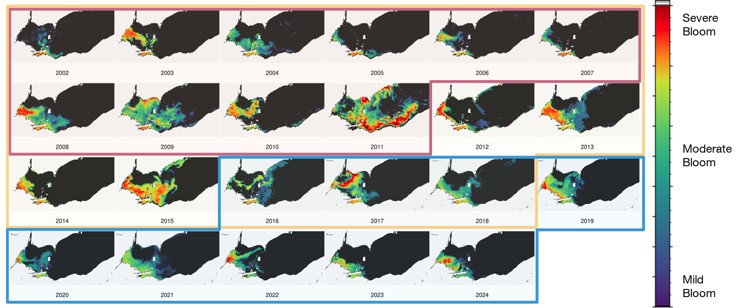
Since 2009, NCCOS has used satellite data to monitor the severity and impacts of annually occurring cyanobacteria Harmful Algal Blooms (cyanoHABs) in Lake Erie by leveraging satellite imagery across three different satellite missions. Following the 2024 bloom, NCCOS reprocessed the full time series with new satellite calibrations and improved algorithms. This reprocessing resulted in the most consistent and complete satellite imagery time series for Lake Erie across all three satellite missions from 2000 to present. Learn more about the methods used and updated time series results with NCCOS’ lead forecaster, Rick Stumpf in an upcoming webinar this Thursday. Register here:
https://ohioseagrant.osu.edu/news/calendar/2025/05/22/yoj75/freshwater-science