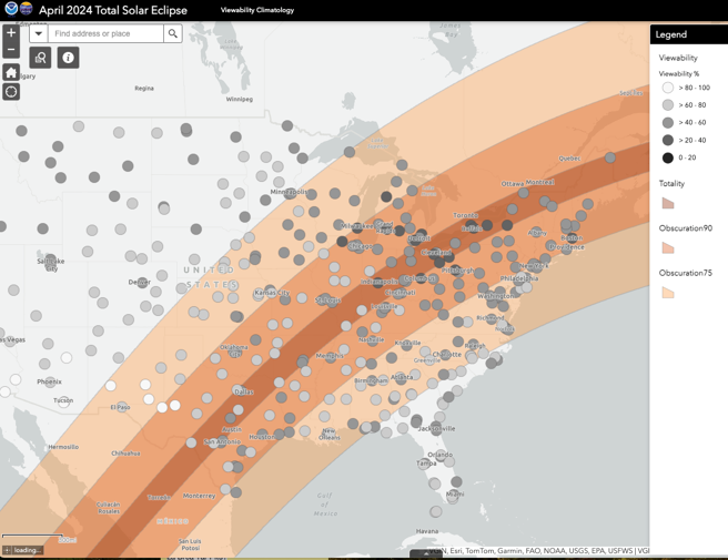
 Worried about weather during the 2024 Solar Eclipse? NOAA’s National Centers for Environmental Information cloudiness map is here to improve your experience! The interactive map shows the average heat index, temperature, dewpoint, wind chill, and obscuration levels across the contiguous U.S.—these values may be useful for finding the best spot in your region for viewing the total eclipse. Learn more: https://www.ncei.noaa.gov/news/take-your-head-out-clouds-view-2024-total-solar-eclipse
Use the cloudiness map to determine cloud cover during the 2024 Solar Eclipse
- Published on:
- Science Area(s): Social Media