NCCOS scientists developed a biogeographic assessment and a geospatial decision support tool to help inform the proposed boundary expansion of the Flower Garden Banks National Marine Sanctuary (FGBNMS) in the Gulf of Mexico. The team analyzed 14 years of data to produce the assessment, including deep-sea information collected with submersibles and remotely operated vehicles, and incorporated 20,000 direct observations of ecologically significant corals in the geospatial tool.
The FGBNMS Advisory Council’s Boundary Expansion Working Group used these products to develop recommended boundaries for 14 proposed new management areas. The working group is composed of representatives from stakeholder groups, including commercial fishing, recreational fishing, oil and gas, research, and conservation. Last month, the Sanctuary Advisory Council approved the working group’s proposal and forwarded the recommendations to the Office of National Marine Sanctuaries for consideration and further action.

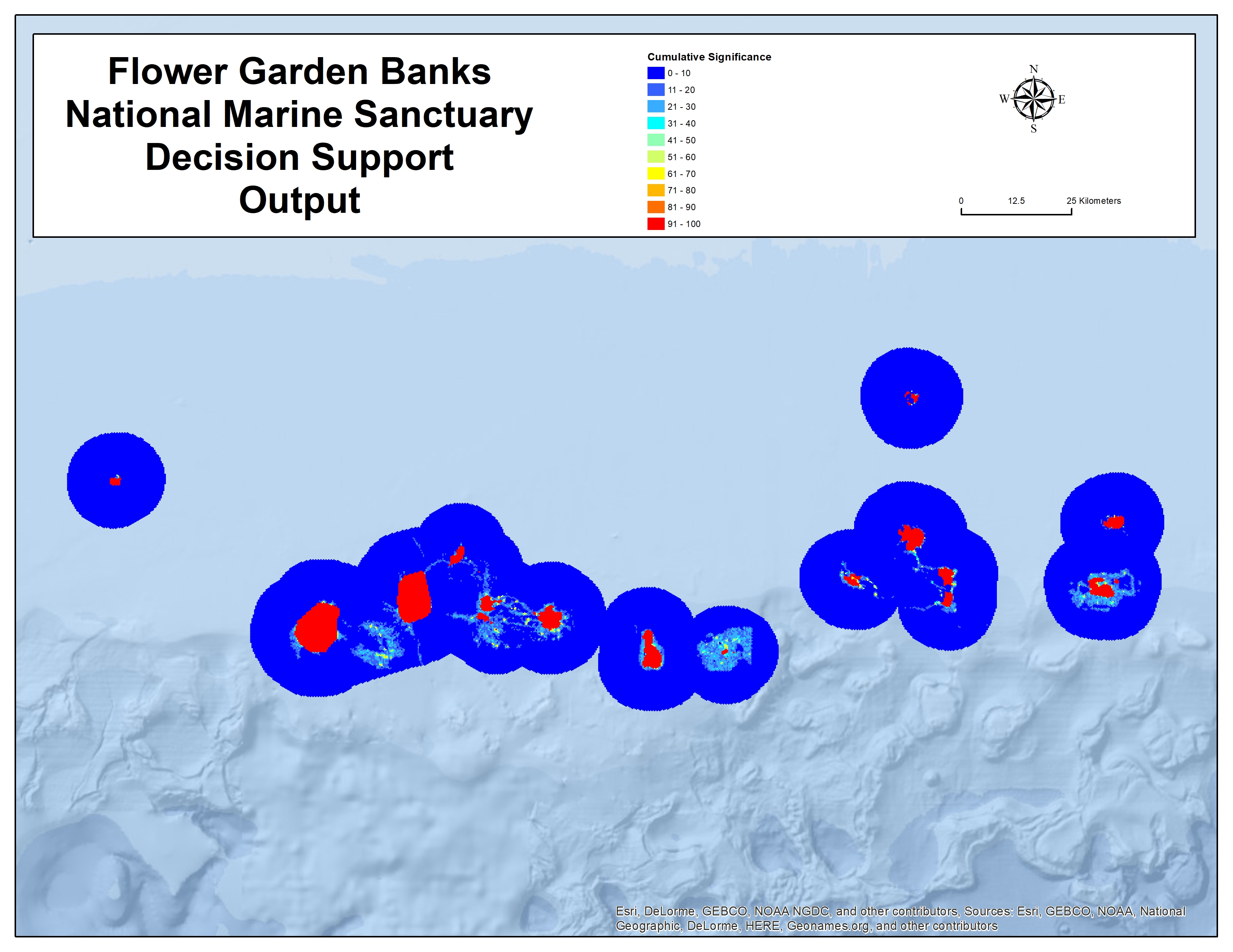
The top map depicts the current sanctuary boundaries (black), and the proposed expansion boundaries (yellow). The bottom map shows the decision summary outputs of the determined ecological significance of the areas, from low (blue) to high (red), that led to the expansion proposal. Credit: NOAA
For more information, contact Dan.Dorfman@noaa.gov or Randy.Clark@noaa.gov.