 An official website of the United States government.
  Official websites use .gov
A .gov website belongs to an official government organization in the United States.
Official websites use .gov
A .gov website belongs to an official government organization in the United States. Secure .gov websites use HTTPS
A lock or https:// means you’ve safely connected to the .gov website. Share sensitive information only on official, secure websites.
Secure .gov websites use HTTPS
A lock or https:// means you’ve safely connected to the .gov website. Share sensitive information only on official, secure websites.Harmful Algal Bloom Forecasts
Texas Satellite Imagery
Composite 8-days of satellite imagery up to 04-18-2024
showing location of algae bloom which may include algae besides K. brevis
Unable to determine respiratory irritation risk from Karenia brevis, red tide, because no water sampling data available from 04-11-2024 to 04-18-2024.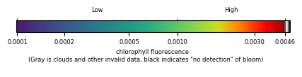
The image was derived from Copernicus Sentinel-3 satellite data from the European Organisation for the Exploitation of Meteorological Satellites (EUMETSAT) and was processed by NOAA, National Centers for Coastal Ocean Science. NOTE: Image quality will vary with clouds and satellite position (OLCI satellite background information). Cell count data were provided by several contributors.
See more information about our bloom monitoring imagery.