 An official website of the United States government.
  Official websites use .gov
A .gov website belongs to an official government organization in the United States.
Official websites use .gov
A .gov website belongs to an official government organization in the United States. Secure .gov websites use HTTPS
A lock or https:// means you’ve safely connected to the .gov website. Share sensitive information only on official, secure websites.
Secure .gov websites use HTTPS
A lock or https:// means you’ve safely connected to the .gov website. Share sensitive information only on official, secure websites.Scientists recently completed the 12thyear of a research expedition to map seafloor habitats in the U.S. Caribbean aboard the NOAA Ship Nancy Foster. Researchers mapped nearly 200,000 underwater acres along St. Croix and St. Thomas, U.S. Virgin Islands and completed 35 remotely operated vehicle dives.
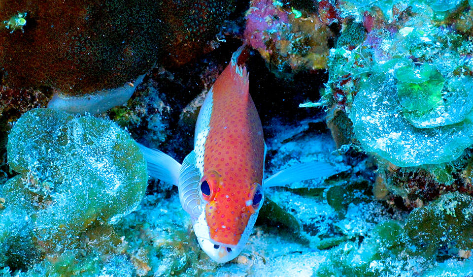
A coney, in its bicolor phase, investigates the camera as the remotely operated vehicle makes a pass over its reef. Exploration with the ROV on these Caribbean reefs helps locate fish and build an understanding of the habitat preferences of different species.
Key findings include the identification of three seamounts rising 25 meters off the seafloor and the discovery of a deep-water snapper assembly along the shelf break of St. Thomas. The mission included outreach to local lawmakers, including the territory's newly elected delegate and governor. Scientists also hosted a coral reef education program for dozens of students.
Work was led by NOAA's National Centers for Coastal Ocean Science with funding from NOAA's Coral Reef Conservation Program.
For more information, contact Tim.Battista@noaa.gov.