 An official website of the United States government.
  Official websites use .gov
A .gov website belongs to an official government organization in the United States.
Official websites use .gov
A .gov website belongs to an official government organization in the United States. Secure .gov websites use HTTPS
A lock or https:// means you’ve safely connected to the .gov website. Share sensitive information only on official, secure websites.
Secure .gov websites use HTTPS
A lock or https:// means you’ve safely connected to the .gov website. Share sensitive information only on official, secure websites.By Ian Hartwell, Senior Scientist for Aquatic Toxicology, NOAA National Status and Trends Program.
We continue to drill the sampling routine. Actually, there is little else to do. We have made all the preparations and plans into the next week. Given that our operations are now dictated by the weather, there is little point in planning beyond that. The captain keeps a keen eye on the weather patterns daily as they develop, but weather predictions in the Arctic are really only good for a few days out. There are far fewer observation points relative to the lower 48. Satellite images help, but hard data is better.
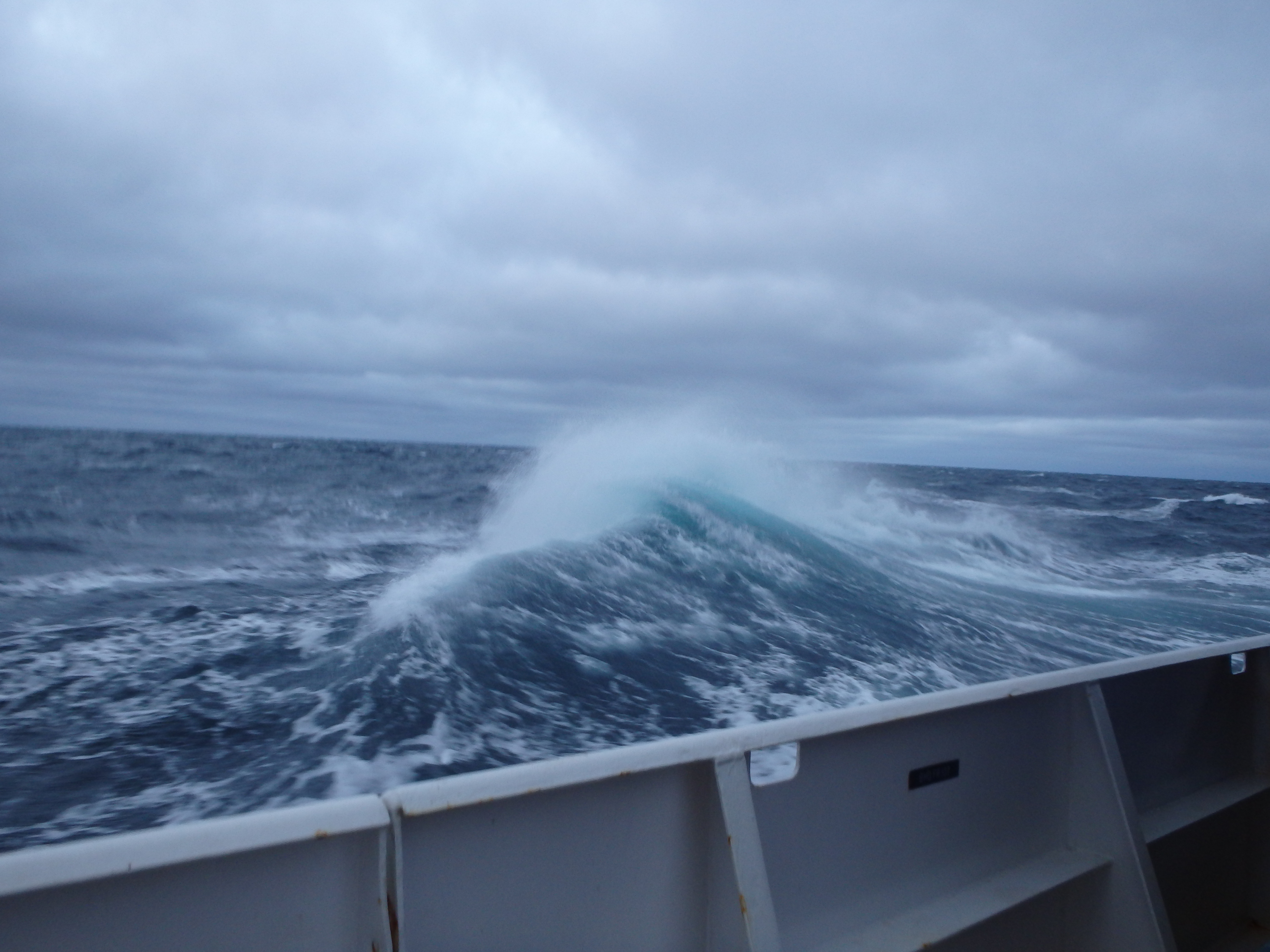
The seas grow rough in the Bering Sea for the scientists and crew on the NOAA ShipRon Brown. Credit: NOAA.
By Friday we finally reach our first sampling area. The wind and waves have been laying down for the last 24 hours. This is a major advantage for the field operation, not only for boarding but also for working off a relatively small boat in close quarters. The weather is good, but we are still bundled up against the cold. We hear it is a hot and uncomfortably muggy August day in Washington, D.C., but you can see your breath up here where the air temperature is in the 30s. It takes an hour to traverse the distance between the ship and Kasegaluk Lagoon. There is a narrow channel that hugs the south side of the inlet that we must follow to gain entry to the lagoon. A broad shoal surrounds the point of the barrier island that forms the north shore. It is much larger than the charts indicate, which demonstrates how outdated the soundings are in such a remote place. We will give the shoals a wider pass on the way out.
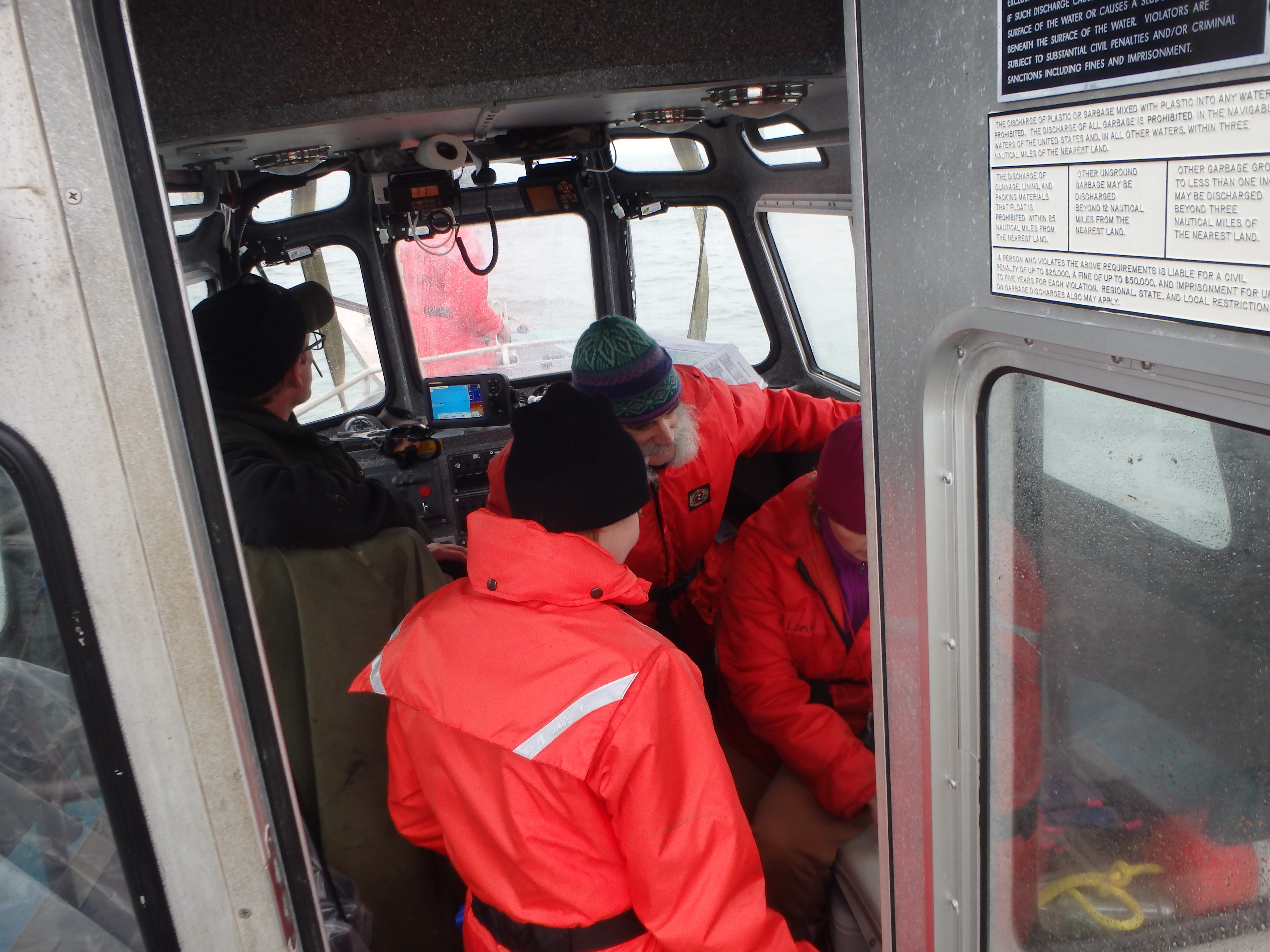
NOAA scientists crowd into the small boat for sampling. Credit: NOAA.
Sampling is only partially successful. The bottom is a combination of fine sand and mud, but it is dense and the bottom grab cannot penetrate very deep. We composite samples from multiple small sample grabs to fill all the sample jars for the various chemical analyses. We can't get a single sample big enough to have a representative picture of the biological community living in the bottom. A disappointing start, but a start at last. The next day most of the crew goes off to sample the Kuk River estuary behind the village of Wainwright. I stay behind with Ens. Rachel Pryor to sample a set of stations in the offshore zone with a much larger and heavier sediment grab sampler. We and the small boat crew have much better success than yesterday, and continue to process sediment, water, and biological samples well into the night.
On Sunday our final pass at the shore zone off Wainwright is for a strip of samples in shallow water, less than 6 fathoms deep (36 ft). We are plagued with problems. The grab won't trigger properly so we lose a lot of time without getting samples. One of the station coordinates were not transferred correctly, so we lose time in transit. The waves are building,as predicted, making it difficult to do everything. We eventually turn back to the ship, where tying up is difficult and dangerous because the waves are much bigger off-shore. Once aboard we sail back south where the other scientific team will run a transect collecting water samples and pelagic organisms. Waves build to 10 feet. You can hear the metallic echo of things slamming and waves pounding on the hull. The decks are awash with spray. It will be a bumpy night.
My berth is on the 03 deck. The lab space and the launch vessel are all on the main deck, three flights below. Working here is like living on a Stairmaster. Someday I'll have to keep track of how may flights of stairs I go up and down in a day.
About this mission:
During August, the State of Alaska Department ofEnvironmental Conservation, NOAA National Status andTrends Program, and the University of Alaska Fairbanks Schoolof Fisheries and Ocean Sciences will be sampling estuaries andbays along the Chukchi and Beaufort Seas. We are planning tostudy sediments, water, and invertebrates (animals that livein the ocean sediments) to learn more about the naturalconditions of these regions. Minimal samples will be collected, and every effort to reduce our impacts will be made.
For more information, contact Ian.Hartwell@noaa.gov.